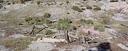
Ghost town in California, United States
| Mono Mills | |
|---|---|
| Ghost town | |
 Mono Mills ruins Mono Mills ruins | |
  | |
| Coordinates: 37°53′15″N 118°57′34″W / 37.88750°N 118.95944°W / 37.88750; -118.95944 | |
| Country | United States |
| State | California |
| County | Mono County |
| Elevation | 7,356 ft (2,242 m) |
Mono Mills (also, Mono) is a ghost town in Mono County, California. It is located 9.5 miles (15 km) east-southeast of Lee Vining, at an elevation of 7356 feet (2242 m). Mono Mills has nearly vanished. Its site is along California State Route 120, 9.1 miles (15 km) east from the junction with U.S. Route 395.
Background
Mono Mills started as a lumber camp that supplied Bodie's mines. The first sawmill was built in 1880. In 1881, a narrow-gauge railroad, Bodie & Benton Railway, was built from Mono Mills to Bodie. At its peak, Mono Mills shipped almost 45,000 cords of wood per year.
Gallery
References
- ^ U.S. Geological Survey Geographic Names Information System: Mono Mills, California
- ^ Durham, David L. (1998). California's Geographic Names: A Gazetteer of Historic and Modern Names of the State. Clovis, Calif.: Word Dancer Press. p. 1186. ISBN 1-884995-14-4.
- ^ Varney, Philip; Drew, John and Susan (2001). Ghost Towns of Northern California: Your Guide to Ghost Towns & Historic Mining Camps. Stillwater, Minnesota: Voyageur Press. p. 135. ISBN 0896584445.
External links
- [REDACTED] Media related to Mono Mills, California at Wikimedia Commons
| Municipalities and communities of Mono County, California, United States | ||
|---|---|---|
| County seat: Bridgeport | ||
| Town |  | |
| Census-designated places | ||
| Unincorporated communities | ||
| Indian reservations | ||
| Former settlements | ||
This Mono County, California-related article is a stub. You can help Misplaced Pages by expanding it. |
This California ghost town-related article is a stub. You can help Misplaced Pages by expanding it. |
