| Mount Studencheskaya | |
|---|---|
| Гора Студенческая | |
 | |
| Highest point | |
| Elevation | 1,421 m (4,662 ft) |
| Prominence | 852 m (2,795 ft) |
| Coordinates | 49°15′16″N 132°18′28″E / 49.25444°N 132.30778°E / 49.25444; 132.30778 |
| Geography | |
| Location | Obluchensky District Jewish Autonomous Oblast, Russian Far East |
| Parent range | Bureya Range |
| Climbing | |
| Easiest route | From Teploozyorsk or Londoko |
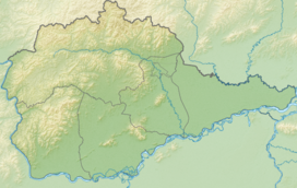
Mount Studencheskaya (Russian: Гора Студенческая) is a peak in the Jewish Autonomous Oblast, Russia. It is the highest point of the oblast.
Description
Mount Studencheskaya is a 1,421 metres (4,662 ft) high mountain located near the southern end of the Bureya Range, close to the Khabarovsk Krai border. It rises in the Obluchensky District, on the northern part of the Jewish Autonomous Oblast, north of the valley of the Sutara, one of the rivers forming the Bira, a tributary of the Amur.
See also
References
- ^ "Топографска карта M-53; M 1:1 000 000 - Topographic USSR Chart (in Russian)". Retrieved 20 December 2021.
- ^ Mt Studencheskaya, Russia - PeakVisor
- Еврейская автономная область - Географическое положение и рельеф
- Google Earth
External links
This Jewish Autonomous Oblast location article is a stub. You can help Misplaced Pages by expanding it. |