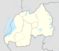
| Muhima | |
|---|---|
| Sector | |
 | |
| Coordinates: 1°56′9″S 30°3′12″E / 1.93583°S 30.05333°E / -1.93583; 30.05333 | |
| Country | |
| Province | Kigali Province |
| District | Nyarugenge |
| Area | |
| • Total | 2.944 km (1.137 sq mi) |
| Population | |
| • Total | 22,531 |
| • Density | 7,700/km (20,000/sq mi) |
| (2022 census) | |
| Time zone | UTC+2 (CAT) |
| • Summer (DST) | UTC+2 (not observed) |
Muhima is a sector (umurenge) in the Kigali Province, Nyarugenge district, Rwanda. It is located in the west part of the city of Kigali.
Religion
Muhima is home to the Sainte-Famille Catholic church.
Demographics
In 2012, Its population was 29,768 inhabitants.
According to the 2022 census, the sector had a total population of 14,754 inhabitants, with the following Gender demographics:
- Males 12,286
- Females 10,245
The Rwanda Environment Management Authority hypothesised that the high male-to-female ratio was due to a tendency for men to migrate to the city in search of work outside the agricultural sector, while their wives remained in a rural home.
As of 2022 it had a 100% Urban rate. It is quite young with 22.1% of the population is under 15 and 75.7% of the population being younger than 65, and older than 14. Only 2.2% of the population is older than 64.
Inhabited places
Sectors are divided into subdivisions. These are the list of subdivisions.
References
- "Muhima (Sector, Rwanda) - Population Statistics, Charts, Map and Location". citypopulation.de. Retrieved 2023-12-23.
- "na.unep.net" (PDF).
- "Muhima (Sector, Rwanda) - Population Statistics, Charts, Map and Location". citypopulation.de. Retrieved 2023-12-23.
This Rwanda location article is a stub. You can help Misplaced Pages by expanding it. |