| Mynydd Llwydiarth | |
|---|---|
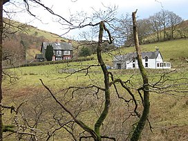
 Llwydiarth Hall on the southern slopes of Mynydd Llwydiarth Llwydiarth Hall on the southern slopes of Mynydd Llwydiarth | |
| Highest point | |
| Elevation | 467 m (1,532 ft) |
| Naming | |
| Language of name | Welsh |
| Geography | |
| Location | Gwynedd, UK |
| Parent range | Snowdonia |
Mynydd Llwydiarth is a mountain in southern Snowdonia, Wales. It is a long ridge running from a low summit to the south of Mynydd Dolgoed, running south-west to Mynydd Cymerau. Nant Llwydiarth rises on the south flank of the mountain, and on the west slope the Ratgoed slate quarry operated until 1946.
It is one of the Dyfi hills.
References
- Merionethshire XXXVIII.SW (Map). Ordnance Survey. Retrieved 9 September 2019.
- Cylchgrawn Cymdeithas Hanes a Chofnodion Sir Feirionydd. The Society. 1957.
- Richards, Alun John (1994). Slate Quarrying at Corris. Carreg Gwalch. ISBN 978-0-86381-279-8.
52°42′28″N 3°46′56″W / 52.70769882°N 3.78222972°W / 52.70769882; -3.78222972
Categories: