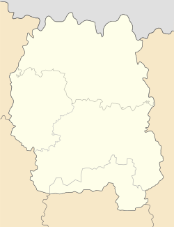
| Myroliubiv Миролюбів | |
|---|---|
| Rural settlement | |
  | |
| Coordinates: 51°15′N 28°07′E / 51.25°N 28.12°E / 51.25; 28.12 | |
| Country | |
| Oblast | |
| Raion | Korosten Raion |
| Time zone | UTC+2 (EET) |
| • Summer (DST) | UTC+3 (EEST) |
Myroliubiv (Ukrainian: Миролюбів), until May 2016 Zhovtneve (Ukrainian: Жовтневе), is a rural settlement in Korosten Raion, Zhytomyr Oblast, Ukraine. Population: 576 (2022 estimate) In 2001, population was 671.
History
On 21 May 2016, Verkhovna Rada adopted decision to rename Zhovtneve to Myroliubiv according to the law prohibiting names of Communist origin.
Until 26 January 2024, Myroliubiv was designated urban-type settlement. On this day, a new law entered into force which abolished this status, and Myroliubiv became a rural settlement.
References
- Чисельність наявного населення України на 1 січня 2022 [Number of Present Population of Ukraine, as of January 1, 2022] (PDF) (in Ukrainian and English). Kyiv: State Statistics Service of Ukraine. Archived (PDF) from the original on 4 July 2022.
- "Pro perejmenuvannja dejakih naselenih punktiv" (in Ukrainian). Holos Ukrainy. 21 May 2016. Retrieved 1 June 2016.
- "Что изменится в Украине с 1 января". glavnoe.in.ua (in Russian). 1 January 2024.
51°14′56″N 28°7′11″E / 51.24889°N 28.11972°E / 51.24889; 28.11972
This article about a location in Zhytomyr Oblast is a stub. You can help Misplaced Pages by expanding it. |