Township in Shan State, Burma
| Namhkam နမ့်ခမ်းမြို့နယ် | |
|---|---|
| Township | |
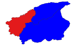
 Location in Muse district Location in Muse district | |
 | |
| Coordinates: 23°50′0″N 97°40′0″E / 23.83333°N 97.66667°E / 23.83333; 97.66667 | |
| Country | |
| State | Shan State |
| District | Mu Se District |
| Area | |
| • Total | 466.85 sq mi (1,209.14 km) |
| Elevation | 2,489 ft (759 m) |
| Highest elevation | 7,741 ft (2,359 m) |
| Population | 116,744 |
| • Ethnicities | |
| • Religions | Buddhism |
| Time zone | UTC+6:30 (MMT) |
Namhkam Township (also known as Nanhkan Township) is a township of Mu Se District in the Shan State of eastern Myanmar. The principal town is Namhkam, a few miles away from Mu Se.
Inhabitants
A large majority of the people in Namhkam Township are Shan and Kachin with a smaller presence of the Palaung.
Economy
According to a survey conducted in 16 villages, poppy cultivation increased from 812 acres (328 hectares) to 1,535 acres (617 hectares) from the 2006–2007 season to the 2008–2009 season.
Unrest
The Shan State Army-North (SSA-N) and Shan State National Army (SSNA) are active in Namhkam Township. Pansay Militia is one of eight influential militias. Kyaw Myint, head of Pansay militia, was selected as a USDP candidate of Namhkam for Shan State Hluttaw.
References
- GoogleEarth
- ^ Myanmar Information Management Unit (2019). Namhkan Myone Daethasaingyarachatlatmya နမ့်ခမ်းမြို့နယ် ဒေသဆိုင်ရာအချက်လက်များ [Namkham Township Regional Information] (PDF) (Report). MIMU. Retrieved 8 November 2023.
- Palaung Land
- Poisoned hills page 17
- "Police reinforcements in Nam Kham town". Archived from the original on 3 September 2014. Retrieved 27 January 2015.
- Poisoned Hills page 10
- BurmaNet News, September 25 - 27, 2010
- Stolen Lives
This Shan State location article is a stub. You can help Misplaced Pages by expanding it. |

