| This article does not cite any sources. Please help improve this article by adding citations to reliable sources. Unsourced material may be challenged and removed. Find sources: "National Highway 3" Myanmar – news · newspapers · books · scholar · JSTOR (September 2013) (Learn how and when to remove this message) |
| National Highway 3 | |
|---|---|
| အမျိုးသားအဝေးပြေး 3 | |
 | |
| Route information | |
| Part of | |
| Length | 477 km (296 mi) |
| Major junctions | |
| South end | Mandalay |
| North end | Muse |
| Location | |
| Country | Myanmar |
| Highway system | |
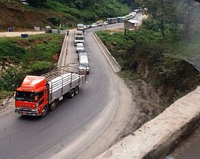
National Highway 3 (NR3) is one of the most important highways of central-eastern Myanmar. It connects Mandalay to Muse on the border with China.

The highway is fed by the National Highway 1 at Mandalay at 21°58′58″N 96°5′14″E / 21.98278°N 96.08722°E / 21.98278; 96.08722 coming from the south and 26th Street from the west. It initially goes in an easterly direction until it reaches the northeast suburb of Mandalay and then skirts the city outskirts by changing direction to the south. After moving in a southeasterly direction for several kilometres (a few miles) it then moves towards the northeast for most of its passage. At Hsenwi it joins the National Road 34 to the east and continues north-northeast until it reaches Muse, where it is joined from National Road 36 from the southwest at 23°59′49″N 97°54′5″E / 23.99694°N 97.90139°E / 23.99694; 97.90139.
| National Roads of Myanmar | |
|---|---|
| Highways | |
| Roads | |
This Burmese road, street or road transport-related article is a stub. You can help Misplaced Pages by expanding it. |