| Neguela | |
|---|---|
| Town | |
 | |
 | |
| Coordinates: 12°51′51″N 8°27′6″W / 12.86417°N 8.45167°W / 12.86417; -8.45167 | |
| Country | |
| Region | Koulikoro Region |
| Cercle | Neguela |
| Commune | Bossofala |
| Elevation | 350 m (1,150 ft) |
| Time zone | UTC+0 (GMT) |
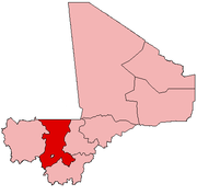
Neguela is a cercle in the Koulikoro Region of south-western Mali. The lies 61 km northwest of Bamako, the Malian capital.

References
- Communes de la Région de Koulikoro (PDF) (in French), Ministère de l’administration territoriale et des collectivités locales, République du Mali, archived from the original (PDF) on 2012-03-09.
This article is a stub. You can help Misplaced Pages by expanding it. |
