 | |
| Location | Victoria Land |
|---|---|
| Coordinates | 76°44′S 159°55′E / 76.733°S 159.917°E / -76.733; 159.917 |
| Terminus | Mawson Glacier |
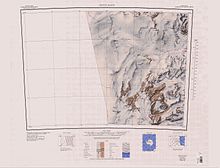
The Odell Glacier (76°44′S 159°55′E / 76.733°S 159.917°E / -76.733; 159.917) is a glacier draining northeast between Allan Hills and Coombs Hills into the upper Mawson Glacier in Victoria Land, Antarctica. It was named by the New Zealand Antarctic Place-Names Committee (NZ-APC) for Noel Odell, who was a mountaineer and was professor of geology at the University of Otago from 1950 to 1955.
Location
The Odell Glacier forms between the Allan Hills and the Coombs Hills, which contain Mount Brooke. To the southwest of its head are Hall Rock, Brandau Rocks and Carapace Nunatak. The glacier flows northeast past the Convoy Range to the Mawson Glacier.
Field camp
The United States set up an Antarctic field camp on the glacier during the summer of 2001 at 76°39′00″S 159°58′00″E / 76.65000°S 159.96667°E / -76.65000; 159.96667.
Tributary
Irving Glacier
76°13′00″S 160°16′00″E / 76.2166667°S 160.2666667°E / -76.2166667; 160.2666667. A glacier that flows northwest between Coombs Hills and Wyandot Ridge to enter Odell Glacier. Named in association with nearby Wyandot Ridge after Captain R.K. Irving, U.S. Navy (USN), commander of USS Wyandot (AKA-92), a cargo ship in the Ross Sea Unit in Operation Deep Freeze IV, 1958-59.
Features
Map all coordinates using OpenStreetMapDownload coordinates as:

Features of the terrain around the glacier include:
Coombs Hills
76°47′S 160°00′E / 76.783°S 160.000°E / -76.783; 160.000. An area of broken and largely snow-free hills and valleys between the Odell Glacier and Cambridge Glacier. Discovered in 1957 by the New Zealand Northern Survey Party of the Commonwealth Trans-Antarctic Expedition (CTAE) (1956-58) and named by them for Doug Coombs, professor of geology at the University of Otago, New Zealand, who assisted the expedition in obtaining essential petrological equipment.
Mount Brooke
76°49′S 159°54′E / 76.817°S 159.900°E / -76.817; 159.900. A large isolated mountain, 2,675 metres (8,776 ft) high, standing 17 nautical miles (31 km; 20 mi) northwest of Mount Gran and dominating the area near the heads of Mackay Glacier and Mawson Glacier. Named for Lieutenant Commander F.R. Brooke, Royal Navy, leader of the 1957 New Zealand Northern Survey Party of the CTAE, 1956-58.
Hall Rock
76°51′S 159°20′E / 76.850°S 159.333°E / -76.850; 159.333. A large rock located 2 nautical miles (3.7 km; 2.3 mi) northwest of Carapace Nunatak at the edge of the Antarctic Plateau. Named by the United States Advisory Committee on Antarctic Names (US-ACAN) for geologist Bradford A. Hall who, with Harold W. Borns, did research on the so-called Mawson Tillite in this vicinity, 1968-69.
Brandau Rocks
76°53′S 159°20′E / 76.883°S 159.333°E / -76.883; 159.333. Rock exposures 0.5 nautical miles (0.93 km; 0.58 mi) west of Carapace Nunatak. Reconnoitered by the New Zealand Antarctic Research Programme (NZARP) Allan Hills Expedition (1964), who named the rocks for Lieutenant Commander James F. Brandau, United States Navy, helicopter pilot who made a difficult rescue flight to evacuate an injured member of the expedition.
Carapace Nunatak
Main article: Carapace Nunatak76°53′S 159°24′E / 76.883°S 159.400°E / -76.883; 159.400. A prominent isolated nunatak, the most westerly near the head of Mackay Glacier, standing 8 nautical miles (15 km; 9.2 mi) southwest of Mount Brooke where it is visible for a considerable distance from many directions. So named by the New Zealand party of the CTAE (1956-58) because of the carapaces of small crustaceans found in the rocks.
References
- Alberts 1995, p. 539.
- Convoy Range USGS.
- Irving Glacier USGS.
- Alberts 1995, p. 151.
- Alberts 1995, p. 96.
- Alberts 1995, p. 307.
- Alberts 1995, pp. 88–89.
- Alberts 1995, p. 118.
Sources
- Alberts, Fred G., ed. (1995), Geographic Names of the Antarctic (PDF) (2 ed.), United States Board on Geographic Names, retrieved 2024-01-30
 This article incorporates public domain material from websites or documents of the United States Board on Geographic Names.
 - Convoy Range, USGS: United States Geological Survey, retrieved 2024-01-30
- "Irving Glacier", Geographic Names Information System, United States Geological Survey, United States Department of the Interior
![]() This article incorporates public domain material from websites or documents of the United States Geological Survey.
This article incorporates public domain material from websites or documents of the United States Geological Survey.