| This article includes a list of general references, but it lacks sufficient corresponding inline citations. Please help to improve this article by introducing more precise citations. (February 2020) (Learn how and when to remove this message) |
| Oroslavje | |
|---|---|
| Town | |
 Church in Oroslavje Church in Oroslavje | |
  | |
| Coordinates: 46°00′N 15°55′E / 46.00°N 15.91°E / 46.00; 15.91 | |
| Country | |
| County | |
| Government | |
| • Mayor | Viktor Šimunić (Ind.) |
| Area | |
| • Town | 32.0 km (12.4 sq mi) |
| • Urban | 7.8 km (3.0 sq mi) |
| Population | |
| • Town | 5,834 |
| • Density | 180/km (470/sq mi) |
| • Urban | 3,253 |
| • Urban density | 420/km (1,100/sq mi) |
| Time zone | UTC+1 (Central European Time) |
| Website | oroslavje |
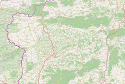
Oroslavje (Croatian pronunciation: [ôroslaːvje]) is a town and municipality in Krapina-Zagorje County in Croatia.
Oroslavje is often referred to as The Gate of Croatian Zagorje (Vrata Hrvatskog zagorja) because of its geographical position and its proximity to The City of Zagreb and Zagreb County.
Location and transport
Oroslavje is considered to be a town with a good location in Croatia.
Oroslavje is ~30 min (31 km (19 mi)) from the capital of The Republic of Croatia, Zagreb. Oroslavje has an entrance/exit point to the A2 Motorway connecting Zagreb to the border crossing Macelj/Gruškovje with Slovenia. Oroslavje also has two entrance/exit points to the D14 Freeway in Croatia connecting the A2 Motorway with Zabok, Bedekovčina, finishing in Zlatar Bistrica. Further expansion of the road to the A4 Motorway which could then be used to get to Zagreb or Varaždin is in progress.
It has frequent public transit. Busses and trains are commonly used.
Demographics
In the 2011 census, there were 6,124 inhabitants in the following settlements:
- Andraševec, population 859
- Krušljevo Selo, population 523
- Mokrice, population 758
- Oroslavje, population 3,368
- Stubička Slatina, population 630
In the census of 2011, the absolute majority were Croats.
Town of Oroslavje: Population trends 1857–2021| population | 2199 | 2713 | 3206 | 3565 | 3745 | 3958 | 4008 | 4947 | 5485 | 5192 | 5339 | 5661 | 6268 | 6576 | 6253 | 6138 | 5834 |
| 1857 | 1869 | 1880 | 1890 | 1900 | 1910 | 1921 | 1931 | 1948 | 1953 | 1961 | 1971 | 1981 | 1991 | 2001 | 2011 | 2021 |
Culture and history

The history of the city is tightly connected with the two castles in the town of Oroslavje. Oroslavje used to have two castles, but now only has one. The castle in so-called "Gornje Oroslavje" or "Upper Oroslavje" used to belong to the Čuklins, followed by the Vranyczanys. It was almost completely destroyed in the fire of 1949 and was later demolished. The only thing saved was the French-style park in front of the castle with a fountain.

The second castle that used to be owned by the Vojkiffy family remained whole, but it is currently in bad shape.
The Oroslavje church is supposed to be built in 1652 or 1653. It is first mentioned in historical sources in 1669. Its current shape was made in the beginning of the 20th century. The church is currently undergoing renovations.
The town day is on 11 August. Every year there is a festival held the week of the town day. Typically, there are many attractions, concerts performed by famous Croatian singers and groups, amusement parks, and so on.
Education
- Elementary school Oroslavje
- District school Krušljevo Selo (Krušljevo Village)
- High school Oroslavje Archived 2020-02-22 at the Wayback Machine
- Open University Oroslavje Archived 2020-02-20 at the Wayback Machine
Sport
- Ski running club Oroslavje
- Football club Oroslavje (link to Croatian site)
- Handball club Oroslavje
- Chess club Oroslavje
- Tennis club Oroslavje
- Car-Motorcycle club Oroslavje
- Shooting club Oroslavje
- Hunting club "Mokrice"
- Hunting club "Kuna"
- Paintball club Dum-Dum (link to Croatian site) Archived 2013-10-14 at the Wayback Machine
- Athletic club Oroslavje
- Bowling club "Obrtnik" Oroslavje
Since 2005 the FIS Roller Ski Cup (link to Croatian site) is held in Oroslavje
References
- Register of spatial units of the State Geodetic Administration of the Republic of Croatia. Wikidata Q119585703.
- "Population by Age and Sex, by Settlements" (xlsx). Census of Population, Households and Dwellings in 2021. Zagreb: Croatian Bureau of Statistics. 2022.
- "Official town page referring to Oroslavje as the "Vrata Hrvatskog zagorja"".
- "Population by Age and Sex, by Settlements, 2011 Census: Oroslavje". Census of Population, Households and Dwellings 2011. Zagreb: Croatian Bureau of Statistics. December 2012.
- Žmegač, Andrej; Vojtić, Marijana (2013). "Dvorac Gornje Oroslavje" [Gornje Oroslavje Castle] (PDF). Peristil (in Croatian). 56 (1): 247–254. doi:10.17685/Peristil.56.22. Retrieved 26 February 2020.
- "Town official data on the history of Oroslavje".
- "Oroslavje official town data on the Oroslavje church". Archived from the original on 2020-10-30. Retrieved 2020-02-19.
External links
- Official website
- Elementary school Oroslavje
- High school Oroslavje Archived 2020-02-22 at the Wayback Machine
| Subdivisions of Krapina-Zagorje County | ||
|---|---|---|
| Towns |  | |
| Municipalities |
| |
This Krapina-Zagorje County geography article is a stub. You can help Misplaced Pages by expanding it. |