| Pan de Guajaibón | |
|---|---|
 | |
| Highest point | |
| Prominence | 699 m (2,293 ft) |
| Coordinates | 22°47′14″N 83°22′06″W / 22.78722°N 83.36833°W / 22.78722; -83.36833 |
| Geography | |
 | |
| Parent range | Guaniguanico |
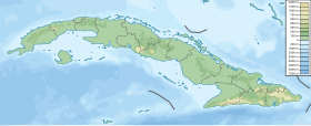
Pan de Guajaibón is a mountain in the Guaniguanico range of western Cuba. It has two peaks, the highest of which is 699 metres above sea level. It is the highest mountain in the Guaniguanico range.
Although most of the Sierra del Rosario stands in Artemisa Province, its mostwestern part is in Pinar del Río Province - including the Pan de Guajaibón.
A bust of Antonio Maceo Grajales is situated at the top of the mountain.
There are also cave systems at the mountain which contain archeological artifacts.
References
- Administrator. "cuba naturaleza .org - Pan de Guajaibon, Sierra Rosario, Pinar del Rio". cubanaturaleza.org.
- "Pan de Guajaibon". peakery.com.
- "Archivo - CUBARTE". CUBARTE.
- ^ "Explorarán Pan de Guajaibón, mayor altura del occidente cubano". Periódico Guerrillero - Pinar del Río, Cuba.
External links
- [REDACTED] Media related to Pan de Guajaibón at Wikimedia Commons
This Cuban location article is a stub. You can help Misplaced Pages by expanding it. |