You can help expand this article with text translated from the corresponding article in Portuguese. (December 2009) Click for important translation instructions.
|
| Paripueira | |
|---|---|
| Municipality of Alagoas, Brazil | |
 Aerial view of Paripueira Aerial view of Paripueira | |
 Flag Flag Coat of arms Coat of arms | |
| Etymology: Means "beach with calm waters" in the indigenous language | |
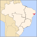
 Location of Paripueira in Alagoas Location of Paripueira in Alagoas | |
  | |
| Coordinates: 9°27′54″S 35°33′7″W / 9.46500°S 35.55194°W / -9.46500; -35.55194 | |
| Country | |
| Region | Northeast |
| State | |
| Founded | 5 October 1989 |
| Government | |
| • Mayor | Carlos Abrahão Gomes de Moura (MDB) (2025-2028) |
| • Vice Mayor | Carlos Augusto Sousa de Castro (MDB) (2025-2028) |
| Area | |
| • Total | 92.788 km (35.826 sq mi) |
| Elevation | 0 m (0 ft) |
| Population | |
| • Total | 13,835 |
| • Density | 149.10/km (386.2/sq mi) |
| Demonym | Paripueirense (Brazilian Portuguese) |
| Time zone | UTC-03:00 (Brasília Time) |
| Postal code | 57935-000 |
| HDI (2010) | 0.605 – medium |
| Website | paripueira.al.gov.br |
Paripueira is a municipality located in the Brazilian state of Alagoas. Its population is 13,332 (2020) and its area is 93 km.
A tourist community, in the Tupi language “paripueira” means “calm waters”. Among the city's attractions are beautiful beaches with tide pools, such as the Praia de Sonho Verde (Green Dream Beach), which stands out for its beauty and for its infrastructure. In this ecological refuge can be found the Amazonian manatee, a threatened species unique to Latin America and protected here by the Municipal Marine Park for the Preservation of the Manatee.
History
| This section is empty. You can help by adding to it. (July 2010) |
Geography
- Borders: Barra de Santo Antônio, Maceió, São Luiz do Quitunde and Atlantic Ocean. 5 meters above sea level.
- Area: 94.1 km
- Climate: Subtropical, hot and humid. High of 36°C (97°F) and low of 23°C (73°F).
- Population: 13,332 inhabitants.
- Electorate: 7,309 voters.
- Economy: Fishing, tourism, sugar cane.
- Education: 2,030 seats (state and municipal systems).
- Health: 2 clinics.
- Access: AL-101 North.
Tourism
Paripueira is one of the longest beaches in Alagoas. At low tide it is possible to walk miles offshore in knee-deep water. The beach has summer homes, fishermen and 25 tide pools, the largest concentration of tide pools in the world. The coral formations in the region are considered the second largest barrier reef in the world.
Gallery
-
 Aerial view of Paripueira
-
 Beach in Paripueira
-
 Beach in Paripueira
-
 Paripueira Beach
-
 Paripueira Beach
-
 Sonho Verde Beach
-
 Beach in Paripueira
-
 Sauaçuhy River
-
 Mangroves in Paripueira
-
 View of Paripueira from the International Space Station
See also
References
- ^ "História". Instituto Brasileiro de Geografia e Estatística. Instituto Brasileiro de Geografia e Estatística. Retrieved 5 October 2024.
- ^ "Paripueira". Instituto Brasileiro de Geografia e Estatística. Instituto Brasileiro de Geografia e Estatística. Retrieved 7 October 2024.
- ^ "Eleições 2024: Abrahão Moura (MDB) | Candidato(a) a prefeito(a) de Paripueira-AL". Folha de S.Paulo (in Brazilian Portuguese). Folha de S.Paulo. 30 November 2024. Retrieved 14 January 2025.
- ^ "Prefeito de Paripueira (AL) toma posse nesta quarta (1º); veja lista de vereadores eleitos". G1 (in Brazilian Portuguese). Globo. 31 December 2024. Retrieved 14 January 2025.
- "Código Postal Paripueira/AL - Brasil". Código Postal. Código Postal. Retrieved 7 October 2024.
- IBGE 2020
- IBGE -
| Capital: Maceió | ||
| Arapiraca |  | |
| Palmeira dos Índios | ||
| Traipu | ||
| Litoral Norte Alagoano | ||
| Maceió | ||
| Mata Alagoana | ||
| Penedo | ||
| São Miguel dos Campos | ||
| Serrana dos Quilombos | ||
| Alagoana do Sertão do São Francisco | ||
| Batalha | ||
| Santana do Ipanema | ||
| Serrana do Sertão Alagoano | ||
This Alagoas, Brazil location article is a stub. You can help Misplaced Pages by expanding it. |