| Podgrađe | |
|---|---|
| Village (Selo) | |
 | |
 | |
   | |
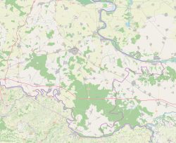
| Coordinates: 45°07′N 19°02′E / 45.11°N 19.03°E / 45.11; 19.03 | |
| Country | |
| Region | Syrmia (Spačva basin) |
| County | |
| Municipality | Nijemci |
| Area | |
| • Total | 27.0 km (10.4 sq mi) |
| Population | |
| • Total | 269 |
| • Density | 10.0/km (26/sq mi) |
| Time zone | UTC+1 (CET) |
| • Summer (DST) | UTC+2 (CEST) |
| Postal code | 32245 Nijemci |
| This article relies largely or entirely on a single source. Relevant discussion may be found on the talk page. Please help improve this article by introducing citations to additional sources. Find sources: "Podgrađe, Vukovar-Syrmia County" – news · newspapers · books · scholar · JSTOR (July 2022) |
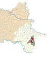
Podgrađe (Hungarian: Váralja) is a village in Syrmia in easternmost part of Croatia along the state border with Serbia. It is administratively part of the Nijemci Municipality, the largest municipality by territory in the county. The population of the village at the time of 2011 census was 371.
References
- Register of spatial units of the State Geodetic Administration of the Republic of Croatia. Wikidata Q119585703.
- "Population by Age and Sex, by Settlements" (xlsx). Census of Population, Households and Dwellings in 2021. Zagreb: Croatian Bureau of Statistics. 2022.
| Nijemci municipality | ||
|---|---|---|
| Settlements |  | |
| Attractions | ||
| History | ||
| Traffic routes | ||
| Notable natives and residents | ||
| Neighboring towns and municipalities | ||
| Villages of Vukovar-Syrmia County | ||
|---|---|---|
| Villages administered as part of cities |  | |
| Villages serving as municipal seat (other villages in municipality) | ||
This Vukovar-Syrmia County geography article is a stub. You can help Misplaced Pages by expanding it. |