| Shavnabada | |
|---|---|
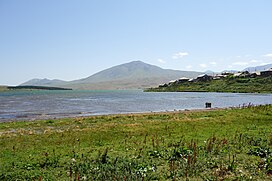
 Shavnabada seen from the village of Tabatskuri Shavnabada seen from the village of Tabatskuri | |
| Highest point | |
| Elevation | 2,929 m (9,610 ft) |
| Coordinates | 41°37′05″N 43°42′33″E / 41.61806°N 43.70917°E / 41.61806; 43.70917 |
| Geography | |
  | |
| Location | Georgia |
| Parent range | Abul-Samsari Range |
Shavnabada (Georgian: შავნაბადა) is a mountain and extinct volcano of 2929 m/9507 ft height in southeastern Georgia. It is one of the highest mountains of the Abul-Samsari Range, a part of the Lesser Caucasus.
References
L. Maruashvili, Georgian Soviet Encyclopedia, V. 10, p. 675, Tbilisi, 1986.
This Georgia location article is a stub. You can help Misplaced Pages by expanding it. |