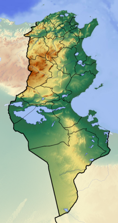
| Sidi Salem Dam | |
|---|---|
 | |
 | |
| Official name | Barrage Sidi Salem |
| Country | Tunisia |
| Location | Testour |
| Coordinates | 36°35′26″N 9°23′49″E / 36.59056°N 9.39694°E / 36.59056; 9.39694 |
| Status | Operational |
| Construction began | 1977 |
| Opening date | 1981 |
| Dam and spillways | |
| Type of dam | Embankment |
| Impounds | Medjerda River |
| Height | 73 m (240 ft) |
| Length | 345 m (1,132 ft) |
| Width (crest) | 9.5 m (31 ft) |
| Dam volume | 4,500,000 m (160,000,000 cu ft) |
| Spillway capacity | 4,300 m/s (150,000 cu ft/s) |
| Reservoir | |
| Total capacity | 650×10 |
| Power Station | |
| Hydraulic head | 75 m (246 ft) avg. |
| Installed capacity | 12 MW (16,000 hp) |
The Sidi Salem Dam is the largest embankment dam in Tunisia located 6 kilometres (3.7 mi) northwest of Testour on the Medjerda River in Béja Governorate, Tunisia. Constructed between 1977 and 1981, the dams supplies water for irrigation and supports a 12 megawatts (16,000 hp) power station.
References
- "Sidi Salem". Hidrotehnika-Hidroenergetika. Retrieved 22 August 2011.
This article about a building or structure in Tunisia is a stub. You can help Misplaced Pages by expanding it. |
This article about a dam, floodgate or canal in Africa is a stub. You can help Misplaced Pages by expanding it. |