| Sombrero Key | |
|---|---|
  | |
| Location | |
| Location | Caribbean |
| Coordinates | 24°37′36″N 81°06′39″W / 24.62667°N 81.11083°W / 24.62667; -81.11083 |
| Country | United States |
| Geology | |
| Type | reef |
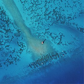
Sombrero Key is a coral reef in the Florida Reef. It lies to the south of Vaca Key.
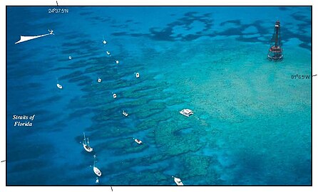
The reef lies within the Sombrero Key Sanctuary Preservation Area of the Florida Keys National Marine Sanctuary.
The Spanish called the reef Cayo Sombrero. As part of the reef was above water at low tide, it was also called "Dry Bank".
The Sombrero Key Light was built on the reef in 1858, and continued in use until 2015. The lighthouse tower is unsafe, and boaters are forbidden from tying up to the tower or climbing on it.
Gallery
-
 NOAA Map of the Sanctuary Preservation Area
-
 Sombrero Key Light at center, and the reef within the Sanctuary Preservation Area is to the south of it.
-
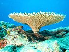
 Oblique view
References
- U.S. Geological Survey Geographic Names Information System: Sombrero Key
- "Sombrero Key Sanctuary Protection Area". NOAA. Retrieved October 28, 2018.
- ^ "Sombrero Key Lighthouse". lighthousefriends.com. Retrieved October 28, 2018.
- Love, Dean (1982). Reef Lights: Seaswept Lighthouses of the Florida Keys. Key West, Florida: The Historic Key West Preservation Board. p. 65. ISBN 0-943528-03-8.
- "Coast Guard cautions boaters of unsafe reef lights in Florida Keys". Coast Guard News. January 29, 2015. Retrieved October 28, 2018.
External links
This article about a specific oceanic location or ocean current is a stub. You can help Misplaced Pages by expanding it. |
