| Sŏsŏng-guyŏk 서성구역 | |
|---|---|
| Guyŏk of Pyongyang | |
| Korean transcription(s) | |
| • Hanja | 西城區域 |
| • McCune-Reischauer | Sŏsŏng-guyŏk |
| • Revised Romanization | Seoseong-guyeok |
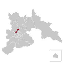
 Location of Sosong-guyok within Pyongyang Location of Sosong-guyok within Pyongyang | |
| Coordinates: 39°03′40″N 125°44′40″E / 39.06111°N 125.74444°E / 39.06111; 125.74444 | |
| Country | North Korea |
| Direct-administered city | P'yŏngyang-Chikhalsi |
| Area | |
| • Total | 12.64 km (4.88 sq mi) |
| Population | |
| • Total | 147,138 |
| • Density | 12,000/km (30,000/sq mi) |
| Sosong-guyok | |
| Hangul | 서성구역 |
|---|---|
| Hanja | 西城區域 |
| Revised Romanization | Seoseong-guyeok |
| McCune–Reischauer | Sŏsŏng-kuyŏk |

Sŏsŏng-guyŏk, or Sosong District, is one of the 18 guyŏk of Pyongyang, North Korea. It is located on the Pot'ong River, west of the Moranbong-guyŏk (Moranbong District) and south of Hyŏngjesan-guyŏk (Hyongjesan District). It was established January 1958.
Administrative divisions
Sŏsŏng-guyŏk is divided into thirteen administrative districts known as dong. Two neighborhoods (Changgyong and Sosan) are further divided in two parts for administrative purposes.
| Chosŏn'gŭl | Hancha | |
|---|---|---|
| Changsan-dong | 장산동 | 長山洞 |
| Changgyŏng-dong | 장경동 | 長慶洞 |
| Chungsin-dong | 중신동 | 中新洞 |
| Hasin-dong | 하신동 | 下新洞 |
| Kinjae-dong | 긴재동 | 긴재洞 |
| Namgyo-dong | 남교동 | 南橋洞 |
| Ryŏnmot-tong | 련못동 | 蓮못洞 |
| Sanghŭng-dong | 상흥동 | 上興洞 |
| Sangsin-dong | 상신동 | 上新洞 |
| Sŏch'ŏn-dong | 서천동 | 西川洞 |
| Sŏsan-dong | 서산동 | 西山洞 |
| Sŏkpong-dong | 석봉동 | 石峰洞 |
| Wasan-dong | 와산동 | 臥山洞 |
References
This North Korea location article is a stub. You can help Misplaced Pages by expanding it. |