Human settlement in England
| St John's | |
|---|---|
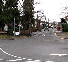
 Shortbutts Lane, St John's, Lichfield Shortbutts Lane, St John's, Lichfield | |
 | |
| Population | 5,924 (2021 Census Ward Profile) |
| • London | 123 mi (198 km) SE |
| Civil parish |
|
| District | |
| Shire county | |
| Region | |
| Country | England |
| Sovereign state | United Kingdom |
| Post town | Lichfield |
| Postcode district | WS14 |
| Dialling code | 01543 |
| Police | Staffordshire |
| Fire | Staffordshire |
| Ambulance | West Midlands |
| UK Parliament | |
| |
St John's is a ward and suburb of Lichfield in the Lichfield District and the ceremonial county of Staffordshire, England. It is one of the six wards on Lichfield City Council and as of September 2024 was represented by Cllrs Colin Greatorex (Con), Deb Baker (Con), Jeyan Anketell (Lab), John Smith (Lib Dem), Katie Farrelly (Lab) and Rosemary Harvey-Coggins (Lab).
Geography

St John's is located to the south of Lichfield City Centre and is close to the villages of Muckley Corner, Pipehill, Shenstone and Wall. It is connected to Birmingham and Tamworth by the A5127 and A51 roads. Lichfield City and Shenstone railway stations are the closest railway stations on the Cross-City Line which passes through the area. Also nearby is the mothballed South Staffordshire Line to Walsall, which is now part of the Fosseway Heath Avenue Wetlands.
Demographics
At the 2021 census, the population of St John's ward profile was 7,276. Of the findings, the ethnicity and religious composition of the ward was:
| :St John's: 2021 Census | |||||||||||||
| Ethnic group | Population | % | |||||||||||
|---|---|---|---|---|---|---|---|---|---|---|---|---|---|
| White | 5,540 | 93.5% | |||||||||||
| Asian or Asian British | 159 | 2.7% | |||||||||||
| Mixed | 150 | 2.6% | |||||||||||
| Black or Black British | 44 | 0.7% | |||||||||||
| Other Ethnic Group | 28 | 0.4% | |||||||||||
| Arab | 2 | 0.1% | |||||||||||
| Total | 5,924 | 100% | |||||||||||
The religious composition of St John's ward at the 2021 Census was recorded as:
| St John's: Religion: 2021 Census | |||||||||||||
| Religious | Population | % | |||||||||||
|---|---|---|---|---|---|---|---|---|---|---|---|---|---|
| Christian | 3,200 | 56.7% | |||||||||||
| Irreligious | 2,275 | 40.3% | |||||||||||
| Muslim | 73 | 1.3% | |||||||||||
| Sikh | 44 | 0.8% | |||||||||||
| Hindu | 19 | 0.3% | |||||||||||
| Other Religion | 18 | 0.3% | |||||||||||
| Buddhist | 12 | 0.2% | |||||||||||
| Jewish | 5 | 0.1% | |||||||||||
| Total | 5,924 | 100% | |||||||||||
References
- Live, Lichfield (24 August 2024). "Developer agrees partnership to deliver affordable homes at Lichfield scheme". Lichfield Live®. Retrieved 8 September 2024.
- Gilmore, Teresa (15 September 2024). Lichfield: A Potted History. Amberley Publishing Limited. ISBN 978-1-3981-0641-3. Retrieved 8 September 2024.
- "Councillors - Lichfield City Council". www.lichfield.gov.uk. Retrieved 8 September 2024.
- "st-johns-streetmap". www.lichfielddc.gov.uk. Retrieved 8 September 2024.
- Live, Lichfield (2 May 2024). "Work begins to create Greenway along route of former railway line between Lichfield and Burntwood". Lichfield Live®. Retrieved 8 September 2024.
- "Towpath Trail Page 46". lhcrt.org.uk. Retrieved 8 September 2024.
- "St John's (Ward, United Kingdom) - Population Statistics, Charts, Map and Location". www.citypopulation.de. Retrieved 8 September 2024.
| Ceremonial county of Staffordshire | |
|---|---|
| Staffordshire Portal | |
| Unitary authorities | Stoke-on-Trent |
| Boroughs or districts | |
| Major settlements (cities in italics) | |
| Rivers | |
| Canals | |
| Topics | |