| Stockade Botanic Park | |
|---|---|
 | |
| Location | Northfield, South Australia |
| Coordinates | 34°50′29″S 138°37′43″E / 34.8415°S 138.6286°E / -34.8415; 138.6286 |
| Operated by | City of Port Adelaide Enfield |
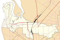
Stockade Botanic Park (commonly known also as Stockade Park and Stockade Botanical Park) is a public reserve off Hoods Road in the City of Port Adelaide Enfield's suburb of Northfield. It was formerly associated with a prison quarry but has now been redesigned with water features, an amphitheatre, and picnic areas.
History
The area originally was the end of the Northfield railway line, first opened in 1857 to service the colony's prisoner camp, then known as The Stockade, and especially to convey bluestone quarried from the banks of Dry Creek. In 1878, the quarry supplied 25,000 tonnes of stone to construction projects in the developing city of Adelaide.
Trains last ran to The Stockade in 1961 and the track was removed in 1973. Subsequently, suburban development occurred nearby in Walkley Heights, and the area was established as a community park.
Description
The park features a lake, water features, an amphitheatre, barbecues, picnic areas and toilets, and is popular for weddings and wedding photography. A sensory garden has been established for the enjoyment of visually impaired people and others.
The park is a part of the 14 kilometres (8.7 miles) Dry Creek River Walking Trail.
See also
References
- Maurovic, Richard (May 2007). "A brief history of the Dry Creek to Stockade railway". Catch Point Magazine. Port Adelaide: National Railway Museum. p. 18.
- 150th Anniversary of the Stockade (Northfield) Line
- "Stockade Botanical Park". www.weekendnotes.com. Retrieved 30 May 2019.
- "Stockade Botanic Park" (PDF).
- "Stockade Park". City of Port Adelaide Enfield. 2021. Retrieved 13 August 2021.
- "Adelaide's best wedding ceremony venues: Stockade Botanical Park". Adelaidecelebrant. 28 November 2013. Retrieved 30 May 2019.
- "Dry Creek River Trails". Walking SA. Retrieved 20 September 2017.
- "Food5085 at Stockade Botanical Park". www.weekendnotes.com. Retrieved 30 May 2019.
34°50′29″S 138°37′43″E / 34.8415°S 138.6286°E / -34.8415; 138.6286
Categories: