| Storm Lake Municipal Airport | |||||||||||||||||||
|---|---|---|---|---|---|---|---|---|---|---|---|---|---|---|---|---|---|---|---|
| Summary | |||||||||||||||||||
| Airport type | Public | ||||||||||||||||||
| Owner | City of Storm Lake | ||||||||||||||||||
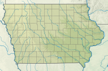
| Location | Storm Lake, Iowa | ||||||||||||||||||
| Elevation AMSL | 1,488 ft / 454 m | ||||||||||||||||||
| Coordinates | 42°35′50″N 95°14′26.4″W / 42.59722°N 95.240667°W / 42.59722; -95.240667 | ||||||||||||||||||
| Website | http://www.stormlake.org/index.aspx?NID=16 | ||||||||||||||||||
| Map | |||||||||||||||||||
  | |||||||||||||||||||
| Runways | |||||||||||||||||||
| |||||||||||||||||||
| Statistics (2009) | |||||||||||||||||||
| |||||||||||||||||||
| Source: Federal Aviation Administration | |||||||||||||||||||
Storm Lake Municipal Airport (IATA: SLB, ICAO: KSLB, FAA LID: SLB) is a city-owned public-use airport located in Storm Lake, Iowa, United States. The airport is mostly used for general aviation.
Facilities and aircraft
Storm Lake Municipal Airport covers an area of 160 acres (65 ha) and contains one turf runway (06/24: 1,962 x 95 ft) and two concrete runways (13/31: 3,035 x 50 ft and 17/35: 5,002 x 75 ft). For the 12-month period ending May 7, 2009, the airport had 19,600 aircraft operations for an average of 54 per day. There are 37 aircraft based at this airport: 36 single-engine and 1 jet.
See also
References
- ^ FAA Airport Form 5010 for SLB PDF, effective 2012-02-09
External links
- Official website
- Resources for this airport:
- FAA airport information for SLB
- AirNav airport information for SLB
- FlightAware airport information and live flight tracker
- SkyVector aeronautical chart for SLB
This article about an airport in Iowa is a stub. You can help Misplaced Pages by expanding it. |