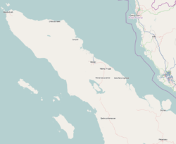
| Tapaktuan | |
|---|---|
| City | |
 A beach in Tapaktuan A beach in Tapaktuan | |
   | |
| Coordinates: 3°15′0″N 97°10′0″E / 3.25000°N 97.16667°E / 3.25000; 97.16667 | |
| Country | Indonesia |
| Region | Sumatra |
| Province | Aceh |
| Area | |
| • Total | 106.99 km (41.31 sq mi) |
| Population | |
| • Total | 22,352 |
| • Density | 210/km (540/sq mi) |
| Time zone | UTC+7 (IWST) |
| Area code | (+62) 627 |
Tapaktuan is a town and administrative district (kecamatan) in the southwest of Aceh province of Indonesia. The town is the capital (seat of the government) of South Aceh Regency. The district covers a land area of 106.99 km, which is subdivided into 18 towns and villages (gampong). According to the official estimates for 2023, it has a population of 22,352.
Climate
Tapaktuan has a tropical rainforest climate (Af) with heavy to very heavy rainfall year-round.
| Climate data for Tapaktuan | |||||||||||||
|---|---|---|---|---|---|---|---|---|---|---|---|---|---|
| Month | Jan | Feb | Mar | Apr | May | Jun | Jul | Aug | Sep | Oct | Nov | Dec | Year |
| Mean daily maximum °C (°F) | 30.9 (87.6) |
31.7 (89.1) |
32.2 (90.0) |
32.5 (90.5) |
32.6 (90.7) |
32.6 (90.7) |
32.3 (90.1) |
32.2 (90.0) |
31.5 (88.7) |
31.3 (88.3) |
30.7 (87.3) |
30.6 (87.1) |
31.8 (89.2) |
| Daily mean °C (°F) | 26.5 (79.7) |
26.8 (80.2) |
27.2 (81.0) |
27.6 (81.7) |
27.8 (82.0) |
27.5 (81.5) |
27.1 (80.8) |
27.2 (81.0) |
26.9 (80.4) |
27.0 (80.6) |
26.6 (79.9) |
26.5 (79.7) |
27.1 (80.7) |
| Mean daily minimum °C (°F) | 22.1 (71.8) |
22.0 (71.6) |
22.3 (72.1) |
22.8 (73.0) |
23.0 (73.4) |
22.5 (72.5) |
22.0 (71.6) |
22.2 (72.0) |
22.4 (72.3) |
22.7 (72.9) |
22.5 (72.5) |
22.4 (72.3) |
22.4 (72.3) |
| Average rainfall mm (inches) | 251 (9.9) |
213 (8.4) |
323 (12.7) |
350 (13.8) |
246 (9.7) |
178 (7.0) |
197 (7.8) |
227 (8.9) |
267 (10.5) |
344 (13.5) |
353 (13.9) |
301 (11.9) |
3,250 (128) |
| Source: Climate-Data.org | |||||||||||||
Further reading
- See The Fourth Circle: A political ecology of Sumatra's rainforest frontier by John F McCarthy (Stanford University Press, 2006).
References
- ^ Badan Pusat Statistik, Jakarta, 26 September 2024, Kecamatan Tapaktuan Dalam Angka 2024 (Katalog-BPS 1102001.1103050).
- "Climate: Tapaktuan". Climate-Data.org. Archived from the original on 15 September 2023. Retrieved 5 November 2020.
This Aceh location article is a stub. You can help Misplaced Pages by expanding it. |