| Texelspitze | |
|---|---|
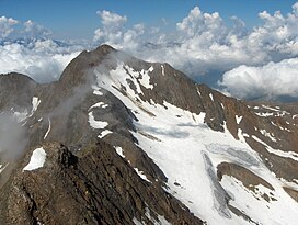
 Texelspitze from Roteck Texelspitze from Roteck | |
| Highest point | |
| Elevation | 3,318 m (10,886 ft) |
| Prominence | 145 m (476 ft) |
| Parent peak | Roteck |
| Coordinates | 46°43′15″N 10°58′17″E / 46.72083°N 10.97139°E / 46.72083; 10.97139 |
| Geography | |
 | |
| Location | South Tyrol, Italy |
| Parent range | Ötztal Alps |
| Climbing | |
| First ascent | 22 jul 1871 by Theodor Petersen and his guides L. Ennemoser and J. Hellriegl |
| Easiest route | Over the southeast face |
The Texelspitze (Italian: Cima Tessa) is the second highest mountain in the Texel group (Gruppo di Tessa) of the Ötztal Alps. The highest mountain of this group is Roteck which is 19m higher.
References
- Klier, Walter (2006). Ötztaler Alpen. Bergverlag Rother. ISBN 978-3-7633-1123-1.
- "Roteck / Monterosso". Summit Post. Retrieved October 6, 2022.
This article about a mountain, mountain range, or peak located in Trentino-Alto Adige/Südtirol is a stub. You can help Misplaced Pages by expanding it. |