| Ulta | |
|---|---|
 Ulta Ulta | |
| Highest point | |
| Elevation | 5,875 m (19,275 ft) |
| Coordinates | 9°08′58.55″S 77°31′21.88″W / 9.1495972°S 77.5227444°W / -9.1495972; -77.5227444 |
| Geography | |
 | |
| Location | Ancash, Peru |
| Parent range | Andes, Cordillera Blanca |
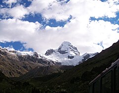
Ulta is a mountain in the Cordillera Blanca in the Andes of Peru, about 5,875 metres (19,275 ft) high (although Peruvian IGN map cites an elevation of 5,782 metres (18,970 ft)). It is in the region of Ancash.
References
- ^ Alpenvereinskarte 0/3a. Cordillera Blanca Nord (Peru). 1:100 000. Oesterreichischer Alpenverein. 2005. ISBN 3-928777-57-2.
- ^ Peru 1:100 000, Carhuás (19-h). IGN (Instituto Geográfico Nacional - Perú).
- ^ Biggar, John (2005). The Andes: A Guide for Climbers. Andes. p. 76. ISBN 9780953608720.