| Werl, Germany | |
|---|---|
| Town | |
 Wallfahrtsbasilika Wallfahrtsbasilika | |
 Coat of arms Coat of arms | |
Location of Werl, Germany within Soest district
 | |
  | |
| Coordinates: 51°33′0″N 7°55′12″E / 51.55000°N 7.92000°E / 51.55000; 7.92000 | |
| Country | Germany |
| State | North Rhine-Westphalia |
| Admin. region | Arnsberg |
| District | Soest |
| Subdivisions | 10 |
| Government | |
| • Mayor (2020–25) | Torben Höbrink (CDU) |
| Area | |
| • Total | 76.24 km (29.44 sq mi) |
| Highest elevation | 228 m (748 ft) |
| Lowest elevation | 73 m (240 ft) |
| Population | |
| • Total | 30,938 |
| • Density | 410/km (1,100/sq mi) |
| Time zone | UTC+01:00 (CET) |
| • Summer (DST) | UTC+02:00 (CEST) |
| Postal codes | 59457 |
| Dialling codes | 02922 |
| Vehicle registration | SO |
| Website | www.werl.de |

The pilgrimage town Werl (German pronunciation: [vɛʁl] ; Westphalian: Wiärl) is a town in North Rhine-Westphalia and belongs to the Soest district in the Arnsberg administrative district. The official name of pilgrimage town has been permitted since January 14, 2015. Werl is one of the largest and most important pilgrimage sites in Germany.
Geography
Geographical location
Werl lies between the Sauerland, the Münsterland, Ruhr area and Hellweg in the fertile Börde landscape of the Werl-Unnaer Börde. At the end of 2018, Werl had 32,994 inhabitants on an area of 76.35 square kilometers; this corresponds to a population density of 432 people/km2. The highest point in the city is at 228.4 m above sea level. NN in the city forest to the south. The deepest point is 73.1 m above sea level. NN in the northern part of the city on the Flerke farm. The city of Werl lies on the southern edge of the Westphalian Bay. Therefore, the terrain profile in the urban area is predominantly flat. In the southern area the terrain rises sharply towards the Haarstrang. It separates the lowlands from the mountainous Sauerland. In the south, the Werl city forest stretches across the hair strand. This is the only area in the city that is densely covered with trees. The Werler part of the lowlands is, in terms of landscape and economy, more dominated by agriculture.
Werl as a middle center
While the surrounding area is more rural, Werl is mainly home to industrial, commercial and service industries. As a middle center in the region, Werl not only provides jobs, but also offers a wide range of schools, further education opportunities at adult education centers, a leisure pool, a city library, a painting school, a music school, a city history museum and a historic old town. Werl also had the "Forum der Völker", an ethnological museum, which closed permanently in early 2024.
Division of the town
Werl consists of the following sections:districts:
- Budberg (584 inhabitants)
- Büderich (3012 inhabitants)
- Hilbeck (1303 inhabitants)
- Holtum (1038 inhabitants)
- Mawicke (499 inhabitants)
- Niederbergstraße (228 inhabitants)
- Oberbergstraße (347 inhabitants)
- Sönnern (856 inhabitants)
- Westönnen (2582 inhabitants)
- Werl (22151 inhabitants)
Neighbouring municipalities
History
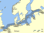
Werl was a member of the Hanseatic League in the Middle Ages and since 1661 has had a statue of the Virgin Mary, making it a place of pilgrimage. Today this relic is in the Wallfahrtsbasilika and is looked after by the Franciscan religious order. Werl Prison is the third largest in North Rhine-Westphalia, Werl Prison.
- The 4th United States Army Field Artillery Detachment was stationed in Werl until 1992.
Mayors
- 1958–1965: Ferdinand Pöppinghaus (1923–1965) (CDU)
- 1965–1981: Amalie Rohrer (1922-2014) (CDU)
- 1981–1985: Heinz Sasse (CDU)
- 1986–1994: Elisabeth Böhmer (CDU)
- 1994–1996: Kunibert Becker (1934-2001) (CDU)
- 1996–1999: Friedrich Leopold Graf von Brühl, (born 1944) (CDU)
- 1999–2020: Michael Grossmann, (born 1948) (CDU)
- since 2020: Torben Höbrink (CDU)
Notable people
- Philipp Rosenthal (1855–1937), businessman and founder of Rosenthal AG at Schloss Erkersreuth in Selb
- Franz von Papen (1879–1969), Conservative politician, diplomat, nobleman and General Staff officer; served as Chancellor of Germany in 1932 and as Vice-Chancellor under Adolf Hitler from 1933 to 1934
- Ulla Wiesner (born 1940), singer
- Theodor Redder (born 1941), footballer
- Dimitri Hegemann (born 1954), cultural manager, musician and founder of the club "Tresor" in Berlin
- Martin Kree (born 1965), footballer
- Uwe Grauer (born 1970), footballer and coach
Twin towns – sister cities
See also: List of twin towns and sister cities in GermanyWerl is twinned with:
 Halle, Belgium (1973)
References
- Wahlergebnisse in NRW Kommunalwahlen 2020, Land Nordrhein-Westfalen, accessed 30 June 2021.
- "Bevölkerung der Gemeinden Nordrhein-Westfalens am 31. Dezember 2023 – Fortschreibung des Bevölkerungsstandes auf Basis des Zensus vom 9. Mai 2011" (in German). Landesbetrieb Information und Technik NRW. Retrieved 2024-06-20.
- Wallfahrtsstadt Werl. "Verwaltungsbericht 2018". Werl.
- admin. "Home". Freizeitbad Werl (in German). Retrieved 2025-01-15.
- "Stadtbücherei". www.werl.de (in German). Retrieved 2025-01-15.
- "Museum Am Rykenberg". www.werl.de (in German). Retrieved 2025-01-15.
- "Endgültiges Aus fürs Museum „Forum der Völker": Werl verliert Sammlung der Welt". www.soester-anzeiger.de (in German). 2024-09-06. Retrieved 2025-01-15.
- "Budberg". www.werl.de (in German). Retrieved 2025-01-15.
- "Büderich". www.werl.de (in German). Retrieved 2025-01-15.
- "Hilbeck". www.werl.de (in German). Retrieved 2025-01-15.
- "Holtum". www.werl.de (in German). Retrieved 2025-01-15.
- "Mawicke". www.werl.de (in German). Retrieved 2025-01-15.
- "Niederbergstraße". www.werl.de (in German). Retrieved 2025-01-15.
- "Oberbergstraße". www.werl.de (in German). Retrieved 2025-01-15.
- "Sönnern". www.werl.de (in German). Retrieved 2025-01-15.
- "Westönnen". www.werl.de (in German). Retrieved 2025-01-15.
- "Städtepartnerschaft mit der belgischen Stadt Halle". werl.de (in German). Werl. Retrieved 2021-02-17.
External links
- Official website
 (in German)
 - Images from Werl (in German)
| Members of the Hanseatic League by quarter, and trading posts of the Hanseatic League | ||||
|---|---|---|---|---|
| ||||
| Wendish |
|   | ||
| Saxon |
| |||
| Baltic |
| |||
| Westphalian |
| |||
| Kontore | ||||
| Vitten | ||||
| Factories | ||||
| Towns and municipalities in Soest (district) | ||
|---|---|---|
This Soest district location article is a stub. You can help Misplaced Pages by expanding it. |
