Human settlement in England
| West Heath | |
|---|---|
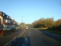
 Longleigh Road in West Heath Longleigh Road in West Heath | |
 | |
| OS grid reference | TQ475775 |
| London borough | |
| Ceremonial county | Greater London |
| Region | |
| Country | England |
| Sovereign state | United Kingdom |
| Post town | LONDON |
| Postcode district | SE2 |
| Postcode district | DA7 |
| Dialling code | 020 & 01322 |
| Police | Metropolitan |
| Fire | London |
| Ambulance | London |
| UK Parliament | |
| London Assembly | |
| 51°28′38″N 0°07′30″E / 51.4771°N 0.1249°E / 51.4771; 0.1249 | |
West Heath is an area of South East London within the London Borough of Bexley. It lies south of Abbey Wood and north of Welling.
Transport
West Heath is served by three Transport for London bus services that connect it with areas including Bexleyheath, Abbey Wood, Erith, Woolwich, Thamesmead and North Greenwich. The nearest rail link to the area is at Abbey Wood station.
Notable people
- Samuel Hulse - lived at West Heath House.
References
- Ordnance Survey: Landranger map sheet 177 East London (Billericay & Gravesend) (Map). Ordnance Survey. 2011. ISBN 9780319232125.
- Willey, Russ. Chambers London Gazetteer, p. 543-4
| Neighbouring areas of West Heath | ||||||||||||||||
|---|---|---|---|---|---|---|---|---|---|---|---|---|---|---|---|---|
| ||||||||||||||||
This London location article is a stub. You can help Misplaced Pages by expanding it. |

