Unincorporated community in the state of Oregon, United States Unincorporated community in Oregon, United States
| West Union, Oregon | |
|---|---|
| Unincorporated community | |
 The five oaks that gave West Union its name The five oaks that gave West Union its name | |
   | |
| Coordinates: 45°33′59″N 122°53′38″W / 45.56639°N 122.89389°W / 45.56639; -122.89389 | |
| Country | United States |
| State | Oregon |
| County | Washington |
| Elevation | 249 ft (76 m) |
| Time zone | UTC-8 (Pacific (PST)) |
| • Summer (DST) | UTC-7 (PDT) |
| ZIP codes | 97123 |
| Area code(s) | 503 and 971 |
| GNIS feature ID | 1163344 |
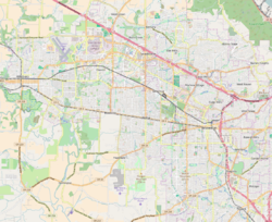
West Union is an unincorporated community in Washington County, Oregon, United States. Founded in 1851, the community had the first school district in the county; it also contains the oldest cemetery in the state and the oldest Baptist church west of the Rocky Mountains. It is located north of Hillsboro near the intersection of West Union Road and Cornelius Pass Road north of the Sunset Highway. The name comes from a grove of five oak trees that was used as a meeting place of early settlers, or the "union of the west." West Union had a post office from 1874 to 1894.
Geography
As defined by the county, the community is located south of West Union Road and north of the Sunset Highway (U.S. Route 26). The eastern boundary is Cornelius Pass Road. West Union is situated on small hills and flat plains with Dawson Creek and Waible Gulch draining the area, both part of the drainage area of the Tualatin River. The community is located 249 feet (76 m) above sea level.
The general community of West Union encompasses a larger area that includes areas to the north and east of the county-defined community area. Since 1983, portions of the community planning area have been annexed into the city of Hillsboro. The population in 1983 was 35 people.
Government
There is no community government for West Union. The community is served by Clean Water Services for municipal sewer, and fire protection is provided by Washington County Fire District 2. West Union lies within District 4 of the Washington County Board of Commissioners and is represented by Andy Duyck. Municipal water service is available from the Tualatin Valley Water District.
School


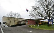
West Union started the first school district in Washington County. The first meeting of the school board was on November 12, 1851. School District No. 1 was directed by David Thomas Lenox, James W. Chamberlain, and Caleb Wilkens, and the school was built on the land claim of the Holcomb family. Classes began in October 1852 after a school was completed on May 17, 1852. Miss E. H. Lincoln was paid $100 for a 12-week term to be the first teacher at the school.
In 1892, the original school was replaced; this second building remained in use until 1949. The current school building opened in 1948. The school district was merged into the Hillsboro School District in 1996. Liberty High School was built in the area in 2003.
Church

West Union Baptist Church was founded in 1844 and the current building was completed in 1853, making it the oldest Baptist church west of the Rocky Mountains. The adjoining cemetery is the oldest in the state. The church was listed on the National Register of Historic Places in 1974.
References
- ^ "West Union". Geographic Names Information System. United States Geological Survey, United States Department of the Interior. November 28, 1980. Retrieved January 14, 2010.
- West Union celebrates 125th year. The Hillsboro Argus, October 19, 1976.
- Post offices, zip codes listed. The Hillsboro Argus, October 19, 1976.
- ^ "West Union Community Plan". Washington County, Oregon. Archived from the original on March 25, 2008. Retrieved December 17, 2007.
- "Map of Commissioner Districts". Washington County, Oregon. Archived from the original on December 13, 2007. Retrieved December 17, 2007.
- ^ West Union claims oldest county school. The Hillsboro Argus, October 19, 1976.
- ^ Buan, Carolyn M. This Far-Off Sunset Land: A Pictorial History of Washington County, Oregon. Donning Company Publishers, 1999.
- "West Union Elementary School". Hillsboro School District. Archived from the original on September 3, 2007. Retrieved December 17, 2007.
- Franzen, Robin. Leaving nothing to chance. The Oregonian, May 30, 1996.
External links
- [REDACTED] Media related to West Union, Oregon at Wikimedia Commons
- Weather Underground
- Picture of the West Union Baptist Church
| Municipalities and communities of Washington County, Oregon, United States | ||
|---|---|---|
| County seat: Hillsboro | ||
| Cities |  | |
| CDPs | ||
| Other communities |
| |
| Ghost towns | ||
| Footnotes | ‡This populated place also has portions in an adjacent county or counties | |