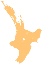

Wimbledon is a farming locality in the Tararua District, New Zealand. It is located on the former SH 52 between Waipukurau and Masterton. It is 21 kilometres (13 mi) from Weber, 9 kilometres (5.6 mi) from Herbertville on the coast, and 11 kilometres (6.8 mi) inland from Cape Turnagain. The Waikopiro Stream runs into the Wainui River at Wimbledon.
Wimbledon has a war memorial, a few farms and a tavern A heritage listed building built in 1886. The area is well known for sheep farming and for exotic breeds of sheep.
The locality was named after Wimbledon in England during the 1880s after a local resident shot a bullock while standing a considerable distance away. It was considered by onlookers to be a shot worthy of the rifle-shooting championships held in Wimbledon at the time.
References
- Peter Dowling, ed. (2004). Reed New Zealand Atlas. Reed Books. pp. map 50. ISBN 0-7900-0952-8.
- Roger Smith, GeographX (2005). The Geographic Atlas of New Zealand. Robbie Burton. pp. map 113. ISBN 1-877333-20-4.
- "Wimbledon war memorial". New Zealand Ministry for Culture and Heritage. Archived from the original on 2 December 2008.
- "Tavern Hawkes Bay – Wimbledon Tavern". www.wimbledontavern.co.nz. Archived from the original on 13 January 2015. Retrieved 17 June 2017.
- "Hundreds flock to Wimbledon for unique day on the farm". The New Zealand Herald. 3 October 2016. Archived from the original on 4 October 2016. Retrieved 17 June 2017.
- "Wimbledon". NZ History. Archived from the original on 11 February 2018.
40°28′S 176°31′E / 40.467°S 176.517°E / -40.467; 176.517
| Tararua District | |
|---|---|
| Populated places | |
| Government | |
This Manawatū-Whanganui geography article is a stub. You can help Misplaced Pages by expanding it. |