| Xiangyang National Forest Recreation Area Chinese: 向阳国家森林游乐区 | |
|---|---|
 | |
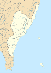
| Map | |
 | |
| Geography | |
| Location | Haiduan, Taitung County, Taiwan |
| Coordinates | 23°15′53.4″N 120°59′12.6″E / 23.264833°N 120.986833°E / 23.264833; 120.986833 |
| Elevation | 2,320―2,700 meters |
| Area | 362 hectares |
Xiangyang National Forest Recreation Area (traditional Chinese: 向陽國家森林遊樂區; simplified Chinese: 向阳国家森林游乐区; pinyin: Xiàngyáng Guójiā Sēnlín Yóulè Qū) is a forest in Lidao Village, Haiduan Township, Taitung County, Taiwan.
Geography
The forest is located at an altitude of 2,320―2,700 meters above sea level and spans over an area of 362 hectares. It has an annual average temperature of 11.4°C. The main vegetations of the forest are pine trees, masters pine trees and red cypress trees.
Architecture
The forest consists of four trails, which are Xiangyang Trail, Songjing Trail, Xiangsong Trail and Songtao Trail. Two of the trails are connected to Jiaminghu National Trail.
See also
References
- "Siangyang National Forest Recreation Area". 農業易遊網. Retrieved 27 May 2022.
- "Xiangyang National Forest Recreation Area". Taiwan, the Heart of Asia. 15 September 2021. Retrieved 27 May 2022.
- ^ "Xiangyang National Forest Recreation Area Trails". Taiwan Forest Recreation. Retrieved 27 May 2022.
This article about a location in Taiwan is a stub. You can help Misplaced Pages by expanding it. |