| This article needs additional citations for verification. Please help improve this article by adding citations to reliable sources. Unsourced material may be challenged and removed. Find sources: "Zabok" – news · newspapers · books · scholar · JSTOR (September 2010) (Learn how and when to remove this message) |
| Zabok | |
|---|---|
| Town | |
| Grad Zabok Town of Zabok | |
 Zabok town center Zabok town center | |
 Flag Flag | |
  | |
| Coordinates: 46°02′N 15°55′E / 46.033°N 15.917°E / 46.033; 15.917 | |
| Country | |
| County | |
| Government | |
| • Type | Mayor-council |
| • Mayor | Ivan Hanžek (SDP) |
| Area | |
| • Town | 34.6 km (13.4 sq mi) |
| • Urban | 4.9 km (1.9 sq mi) |
| Elevation | 186 m (610 ft) |
| Population | |
| • Town | 8,656 |
| • Density | 250/km (650/sq mi) |
| • Urban | 3,408 |
| • Urban density | 700/km (1,800/sq mi) |
| Time zone | UTC+1 (CET) |
| • Summer (DST) | UTC+2 (CEST) |
| Postal code | 49210 Zabok |
| Website | zabok |
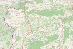
Zabok is a town situated in northwest Croatia in the Krapina-Zagorje County. According to the 2011 census, it has a total population of 8,994, with 2,714 in Zabok itself. Zabok is situated on the main crossroads in the heart of Hrvatsko Zagorje region. Zabok is the economical centre of the Krapina-Zagorje County.
History
In 1782, Sigismund Vojković-Vojkffy started the construction of a church in Zabok, completing it in 1805. With the abolition of the feudalism, former serfs were offered a possibility of choosing their own place of settlement, and the majority settled along the roads connecting Gredice and Bračak with the new centre developing around the church, to form the new city centre. The town reached its final shape in the period after World War II, when it spread longitudinally along the northern side of the railway track.
Geography
Zabok is located at 46°1′46″N 15°54′54″E / 46.02944°N 15.91500°E / 46.02944; 15.91500, at an altitude of 186 m above sea level. The following settlements comprise the town's administrative area:
- Bračak, population 21
- Bregi Zabočki, population 257
- Dubrava Zabočka, population 591
- Grabrovec, population 607
- Grdenci, population 459
- Gubaševo, population 262
- Hum Zabočki, population 457
- Jakuševec Zabočki, population 364
- Lug Zabočki, population 585
- Martinišće, population 338
- Pavlovec Zabočki, population 605
- Prosenik Gubaševski, population 155
- Prosenik Začretski, population 158
- Repovec, population 312
- Špičkovina, population 764
- Tisanić Jarek, population 345
- Zabok, population 2,714
In the 2011 census, 98% of the population were Croats.
Grad Zabok: Population trends 1857–2021| population | 3195 | 3708 | 4086 | 4664 | 4978 | 5558 | 5422 | 6025 | 6852 | 6990 | 7583 | 8696 | 9002 | 9394 | 9365 | 8994 | 8656 |
| 1857 | 1869 | 1880 | 1890 | 1900 | 1910 | 1921 | 1931 | 1948 | 1953 | 1961 | 1971 | 1981 | 1991 | 2001 | 2011 | 2021 |
Politics
The town's major Ivan Hanžek (Social Democratic Party of Croatia) was elected a member of the Croatian Parliament in the 2007 parliamentary election.
Etymology and earliest references
"Zabok" means "behind the river curve" (the river in question is the Krapinica). The name Zabok first appeared in 1335 in a text in which ownership of Zabok was given to Petar, son of Nuzlin, by the Hungarian king, Charles I. The Nuzlin family added the prefix de Zabok to their name and, by the 15th century, had started naming themselves "Zaboky de Zabok".
Culture
Zabok is home to monuments to Antun Gustav Matoš and Katarina Zrinska. The soprano Vlatka Oršanić was born in Zabok and received her early music education at the music school there.

Transportation
Zabok is the central railway hub of Krapina-Zagorje County. It lies on the corridor R201 (Zaprešić-Čakovec) and also serves as a terminus for railway lines to and from Krapina / state border with Slovenia (R106) and Gornja Stubica (L202).
Zabok bus station is served by buses of the company "Presečki d.o.o." which connect the City of Zabok with numerous cities through county and inter-county lines such as Zabok-Zagreb, Zabok-Zlatar, Zabok-Marija Bistrica, Zabok-Krapina, Zabok-Pregrada, Zabok-Hum na Sutli, Zabok-Bedekovčina and Zabok-Oroslavje.
References
- Register of spatial units of the State Geodetic Administration of the Republic of Croatia. Wikidata Q119585703.
- "Population by Age and Sex, by Settlements" (xlsx). Census of Population, Households and Dwellings in 2021. Zagreb: Croatian Bureau of Statistics. 2022.
- "Population by Age and Sex, by Settlements, 2011 Census: Zabok". Census of Population, Households and Dwellings 2011. Zagreb: Croatian Bureau of Statistics. December 2012.
- "Population by Ethnicity, by Towns/Municipalities, 2011 Census: County of Krapina-Zagorje". Census of Population, Households and Dwellings 2011. Zagreb: Croatian Bureau of Statistics. December 2012.
- "Gradonačelnik". zabok.hr (in Croatian). Retrieved 28 January 2014.
- Memorial to Antun Gustav Matoš unveiled in Zabok
- "Otkriven spomenik Katarini Zrinski Frankopan". Archived from the original on 2009-05-01. Retrieved 2009-04-29.
- "Railway line in Croatia between Zapreśic and Zabok rebuilt and electrified-Projects". ec.europa.eu. Retrieved 2022-06-15.
- "R201 railway (Croatia)", Misplaced Pages, 2022-06-06, retrieved 2022-06-15
- "Županijske linije - Autobusne linije - - Putnički promet - Presečki grupa - Putnički promet". www.presecki.hr. Retrieved 2022-06-15.
External links
| Subdivisions of Krapina-Zagorje County | ||
|---|---|---|
| Towns |  | |
| Municipalities |
| |