| Revision as of 22:22, 25 February 2018 edit91.148.96.150 (talk)No edit summary← Previous edit |
Latest revision as of 23:22, 19 October 2024 edit undoDesemeus (talk | contribs)Extended confirmed users1,386 editsNo edit summaryTags: Mobile edit Mobile web edit |
| (22 intermediate revisions by 19 users not shown) |
| Line 1: |
Line 1: |
|
{{Infobox settlement |
|
{{Infobox settlement |
|
| official_name = Brajše |
|
| official_name = Brajše |
|
| native_name = |
|
| other_name = |
|
|
| native_name = Брајше<br/>Brajshë |
|
| settlement_type = Village |
|
| settlement_type = Village |
|
| image_skyline = |
|
| image_skyline = |
| Line 11: |
Line 12: |
|
| image_map = |
|
| image_map = |
|
| map_caption = |
|
| map_caption = |
|
| pushpin_map = |
|
| pushpin_map = Montenegro |
|
| pushpin_label_position = |
|
| pushpin_label_position = left<!-- the position of the pushpin label: left, right, top, bottom, none --> |
|
| pushpin_map_caption = |
|
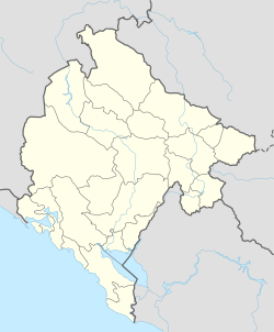
| pushpin_map_caption = Location within Montenegro |
|
| coordinates = |
|
| pushpin_mapsize = |
|
|
<!-- Location ------------------> |
|
| subdivision_type = Country |
|
| subdivision_type = ] |
|
| subdivision_name = {{flag|Montenegro}} |
|
|
| subdivision_type1 = ] |
|
| subdivision_name = ] |
|
| subdivision_name1 = ] |
|
| subdivision_type1 = ] |
|
|
| subdivision_name1 = ] |
|
| established_title = |
|
|
|
| subdivision_type2 = ] |
| ⚫ |
| established_date = |
|
|
|
| subdivision_name2 = ] |
|
| government_footnotes = |
|
| government_footnotes = |
|
| government_type = |
|
| government_type = |
|
| leader_title = |
|
| leader_title = |
|
| leader_name = |
|
| leader_name = |
|
| unit_pref = Imperial |
|
| established_title = |
|
⚫ |
| established_date = |
|
⚫ |
| area_magnitude = |
|
⚫ |
| unit_pref = |
|
| area_footnotes = |
|
| area_footnotes = |
|
| area_total_km2 = |
|
| area_total_km2 = |
|
| area_land_km2 = |
|
| area_land_km2 = |
|
| elevation_footnotes = |
|
| population_as_of = 2011 |
| ⚫ |
| elevation_m = |
|
| ⚫ |
| elevation_ft = |
|
|
| population_footnotes = |
|
| population_footnotes = |
|
⚫ |
| population_note = |
|
| population_total = 682 |
|
| population_total = 682 |
|
| population_as_of = 2011 |
|
|
| population_density_km2 = |
|
| population_density_km2 = |
| ⚫ |
| population_note = |
|
|
| timezone = ] |
|
| timezone = ] |
|
| utc_offset = +1 |
|
| utc_offset = +1 |
|
| timezone_DST = ] |
|
| timezone_DST = ] |
|
| utc_offset_DST = +2 |
|
| utc_offset_DST = +2 |
|
|
| coordinates = {{coord|42.023|19.315|type:city_region:ME|display=inline,title}} |
|
| postal_code_type = |
|
| postal_code_type = |
|
| postal_code = |
|
| postal_code = |
| Line 51: |
Line 54: |
|
}} |
|
}} |
|
|
|
|
|
'''Brajše''' is a village in Montenegro. It is located north-east of ]. |
|
'''Brajše''' ({{lang-cnr-Cyrl|Брајше}}; Albanian: {{lang|sq|Brajshë}}) is a village in the ] of ], ]. It is located north-east of ] town. |
|
|
|
|
|
==Demographics== |
|
==Demographics== |
|
|
|
|
{{historical populations|align=right |
|
{{historical populations|align=right |
|
| title = Population of Brajše |
|
| title = Population of Brajše |
| Line 75: |
Line 77: |
|
| Others || 0 || 0% |
|
| Others || 0 || 0% |
|
|- |
|
|- |
|
| '''Total''' || '''238'''|| '''100%''' |
|
| '''Total''' || '''682'''|| '''100%''' |
|
|} |
|
|} |
|
|
|
|
|
|
|
|
|
|
|
==References== |
|
==References== |
| Line 85: |
Line 85: |
|
{{Ulcinj}} |
|
{{Ulcinj}} |
|
|
|
|
|
{{DEFAULTSORT:Brajše}} |
|
{{DEFAULTSORT:Brajse}} |
|
] |
|
] |
|
] |
|
] |
According to Montenegro's 2011 census, Brajše has a population of 682 of which 344 are men (50.4%) and 338 are women (49.6%). A significant portion of the population (559, or 82.0%) is over the age of 15.
