| Revision as of 04:01, 15 April 2008 edit116.71.211.86 (talk) →History← Previous edit | Revision as of 09:09, 16 April 2008 edit undo116.71.221.95 (talk) →Alexander the Great & AshokaNext edit → | ||
| Line 15: | Line 15: | ||
| The Turkish ] and Hindu Shahi Dynasties ruled Mansehra one after another. Among the Hindu Shahi dynasty rulers, Raja ] is the best known. ] defeated Raja Jayapala during his first Indian campaign. However, there is no historical evidence that Mehmood of Ghazni ever visited or passed through Mansehra. After the fall of Hindu Shahi dynasty, in the ], the Kashmiris took control of this area under the leadership of ] (1063 to 1089). From ] to ], ] ruled this area. In the ], ] captured this area but soon after ]'s death the Kashmiris once again regained control of Mansehra. | The Turkish ] and Hindu Shahi Dynasties ruled Mansehra one after another. Among the Hindu Shahi dynasty rulers, Raja ] is the best known. ] defeated Raja Jayapala during his first Indian campaign. However, there is no historical evidence that Mehmood of Ghazni ever visited or passed through Mansehra. After the fall of Hindu Shahi dynasty, in the ], the Kashmiris took control of this area under the leadership of ] (1063 to 1089). From ] to ], ] ruled this area. In the ], ] captured this area but soon after ]'s death the Kashmiris once again regained control of Mansehra. | ||
| ===Turkish rule=== | |||
| In ], the great Muslim warrior ], on his return to ], stationed his Turk soldiers in Manshera to protect the important route between Kabul and Kashmir. By ], Prince ] came from Kabul and established his rule over the region. Prince Shahab-ud-Din, a Turk of central Asian origin, founded the state and named it Pakhli Sarkar and chose Village Gulibagh as his capital. During the Mughal rule, these local Turkish chiefs acknowledged Mughal authority. In fact, Mansehra (]) provided the main route to Kashmir and was the most commonly used route for ] to travel to Kashmir. During the last days of Emperor Akbar's rule, the Turkish Chief Sultan Hussain Khan revolted against the Mughals. He claimed that the Mughals were interfering with his internal affairs. After this complaint, he was exiled by the Mughals, but later was pardoned and given back his land. Now, descendants of these Turkish rulers live in village ] and some other villages of Mansehra, Abbottabad, and Haripur districts. | |||
| ] | |||
| == Geography and climate== | == Geography and climate== | ||
Revision as of 09:09, 16 April 2008
| It has been suggested that Hazara Division and Talk:Hazara (Pakistan)#Merger proposal be merged into this article. (Discuss) Proposed since February 2008. |
Hazara is a valley and region located in the North-West Frontier Province of Pakistan. Until the year 2000 the region was an administrative subdivision of the NWFP known as Hazara Division - headquartered at the city of Abbottabad. However in 2000 divisions, as part of an administrative shake up, were abolished - although the division has been abolished by the government, the identity and name has still retained been and is used in other areas. For example the University of Hazara based in Mansehra provides higher education to people of the region.
History
Mahabharata evidence , combined with evidence from 7th C Chinese traveller Hiuen Tsang attests that Hazara District of Kashmir had formed part of epic Kamboja and that the Kamboja rulers of this region observed republican system of government .
Alexander the Great & Ashoka

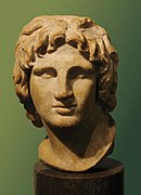
Alexander the Great, after conquering parts of Punjab, established his rule over a large part of Mansehra District. In 327 B.C., Alexander handed this area over to Abisaras (Αβισαρης), the Raja of the Poonch state. Mansehra remained a part of Taxila during the rule of the Maurya dynasty. Ashoka was the Governor of this area when he was a prince, after the death of Ashoka’s father, Bindusara, Ashoka inherited the throne and ruled this area as well as Gandhara. Today, the famous edicts of Ashoka, inscribed on three rocks near Bareri Hill, serve as evidence of his rule. These edicts also show that this area was a famous religious centre for pilgrims. The name Mansehra is a modified form of the name Maan Singh, who once ruled over this area Hazara has several places of significance for the Hindus related to the Pandavas .
'There are the five Pandavas , the heroes of the Mahabharat favourite objects of worship in the east and sometimes addressed as the Panj Pir. Many are the legends current about these heroes and they are localised at quite a number of places . The Hill of Mokshpuri , just above Dunga Gali has an elevation of 9232 feet . Its name means 'the hill of salvation' and on its summit is a Panduan da Sthan , or place of the Pandavas , where it is said they were visited and tempted by Apsaras who still frequent the place .
In the 2nd century CE, a mythical Hindu king Raja Risalu, son of Raja Salbahan of Sialkot, brought the area under his control. The local people consider him as their hero and, even today, parents tell their children the stories of Raja Risalu and his wife Rani Konklan on winter nights. When a Chinese pilgrim, Hiun-Tsang, visited this area, it was under the control of Durlabhavardhana, the ruler of Kashmir.
The Turkish Shahi and Hindu Shahi Dynasties ruled Mansehra one after another. Among the Hindu Shahi dynasty rulers, Raja Jayapala is the best known. Mehmood of Ghazni defeated Raja Jayapala during his first Indian campaign. However, there is no historical evidence that Mehmood of Ghazni ever visited or passed through Mansehra. After the fall of Hindu Shahi dynasty, in the 11th century, the Kashmiris took control of this area under the leadership of Kalashan (1063 to 1089). From 1112 to 1120, King Susala ruled this area. In the 12th century, Asalat Khan captured this area but soon after Mohammad of Ghor's death the Kashmiris once again regained control of Mansehra.
Turkish rule
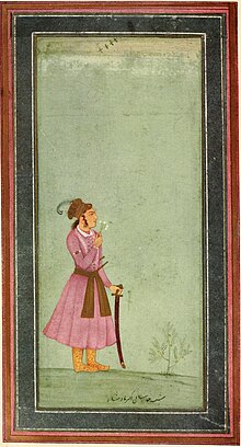
In 1399, the great Muslim warrior Timur, on his return to Kabul, stationed his Turk soldiers in Manshera to protect the important route between Kabul and Kashmir. By 1472, Prince Shahab-ud-Din came from Kabul and established his rule over the region. Prince Shahab-ud-Din, a Turk of central Asian origin, founded the state and named it Pakhli Sarkar and chose Village Gulibagh as his capital. During the Mughal rule, these local Turkish chiefs acknowledged Mughal authority. In fact, Mansehra (Pakhli) provided the main route to Kashmir and was the most commonly used route for Emperor Akbar to travel to Kashmir. During the last days of Emperor Akbar's rule, the Turkish Chief Sultan Hussain Khan revolted against the Mughals. He claimed that the Mughals were interfering with his internal affairs. After this complaint, he was exiled by the Mughals, but later was pardoned and given back his land. Now, descendants of these Turkish rulers live in village Behali and some other villages of Mansehra, Abbottabad, and Haripur districts.

Geography and climate
Hazara is bounded on the north and east by the Northern Areas and Azad Kashmir. To the south are the Islamabad Capital Territory and the province of Punjab, whilst to the west lies the rest of the North-West Frontier Province. The river Indus runs through the division in a north-south line, forming much of the western border of the division. The total area of Hazara is 18,013 km².
Because it lies immediately south of the main Himalaya Range, and is exposed to moist winds from the Arabian Sea, Hazara is the wettest part of Pakistan. At Abbottabad, annual rainfall averages around 1,200mm (47 inches) but has been as high as 1,800mm (70 inches), whilst in parts of Mansehra District such as Balakot the mean annual rainfall is as high as 1,750mm (68 inches). Due to its location on the boundary between the monsoonal summer rainfall regime of East Asia and the winter-dominant Mediterranean climate of West Asia, Hazara has an unusual bimodal rainfall regime, with one peak in February or March associated with frontal southwest cloudbands and another monsoonal peak in July and August. The driest months are October to December, though in the wettest parts even these months average around 40mm (1.6 inches).
Due to the high altitude, temperatures in Hazara are cooler than on the plains, though Abbottabad at 1,200m still has maxima around 32°C (90°F) with high humidity in June and July. Further up, temperatures are cooler - often cooler than the Northern Areas valleys due to the cloudiness. In winter, temperatures are cold, with minima in January around 0°C (32°F) and much lower in the high mountains. Snowfalls are not uncommon even at lower levels.
Population
The population of the Hazara region was estimated to be over 4.5 million in 2005. The total area of Hazara is 18013 km²: See table below.
| District | Area (km²) | Population (Millions) |
| Abbottabad | 1802 | 1 |
| Batagram | 910 | 0.5 |
| Haripur | 1763 | 0.7 |
| Kohistan | 7581 | 0.6 |
| Mansehra | 5957 | 1.4 |
Demographics
Approximately half of the population speaks Gujri and Hindko and most of the rest speak Pashto. Small numbers of people speak other languages, but there is considerable bilingualism and multilingualism amongst the population. The districts of Haripur and Abbottabad have higher literacy rates than most districts of the province.
In addition, Afghan refugees, although predominantly Pashtun (including the Ghilzai and Durrani tribes), and other smaller groups found throughout the Division.
The population of Hazara was estimated to be over 4.5 million in 2005.
The University of Hazara provides higher education to people of the region.
Transport
Hazara lies close to the crossroads formed by the river Indus and the Grand Trunk Road. The Karakoram Highway begins at the town of Havelian and goes north through the division towards China via the Northern Areas.
See also
References
- Hazara -Nordisk familjebok
- MBH 7.4.5; 7/91/39-40.
- Watters, Yuan Chawang, Vol I, p 284.
- See refs: Mahabharata 7/91/39-40; Political History of Ancient India, 1996, p 133, 218/220, Dr H. C. Raychaudhury, Dr B. N. Mukerjee; History of India – 1944, P 94; Narendra Krishna Sinha, Anil Chandra Banerjee; Chilas: The City of Nanga Parvat (Dyamar) – 1983, Page 120, Ahmad Hasan Dani; Indological Studies – 1950, P 18, Dr B. C. Law; A Companion to Middle Indo-Aryan Literature – 1977, P 168, Suresh Chandra Banerji; A Companion to Sanskrit Literature: spanning a period of over three thousand years, containing... – 1971, P 486, Sures Chandra Banerji; Asoka - P 31, Dr R. G. Bhandarkar; J.N. Banerjea Volume: A Collection of Articles by His Friends and Pupils, 1960, p 18, University of Calcutta. Dept. of Ancient Indian History and Culture. Alumni Association.
- A glossary of the tribes and castes of the Punjab and North -West provinces , compiled by H A Rose , vol I Page 120
This Khyber Pakhtunkhwa location article is a stub. You can help Misplaced Pages by expanding it. |