| Revision as of 13:01, 23 April 2010 editXenobot (talk | contribs)197,501 edits Bot) Removing external link per request and discussion, gen fixes (report errors?← Previous edit | Revision as of 10:29, 24 May 2010 edit undoCydebot (talk | contribs)6,812,251 editsm Robot - Moving category Cities, towns and villages in Vojvodina to Populated places in Vojvodina per CFD at Misplaced Pages:Categories for discussion/Log/2010 May 15.Next edit → | ||
| Line 38: | Line 38: | ||
| ] | ] | ||
| ] | ] | ||
Revision as of 10:29, 24 May 2010


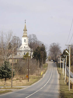
Pačir (Template:Lang-sr / Пачир, Hungarian: Pacsér, Template:Lang-hr) is a village located in the Bačka Topola municipality, in the North Bačka District of Serbia. It is situated in the Autonomous Province of Vojvodina. The village has a Hungarian ethnic majority and its population numbering 2,948 people (2002 census).
Ethnic groups (2002 census)
- Hungarians = 1,766 (59.91%)
- Serbs = 864 (29.31%)
- Bunjevci = 68 (2.31%)
- Yugoslavs = 55 (1.87%)
- Croats = 45 (1.53%)
- Roma = 29 (0.98%)
- others.
Historical population
- 1961: 4,754
- 1971: 4,189
- 1981: 3,871
- 1991: 3,309
- 2002: 2,948
See also
References
- Slobodan Ćurčić, Broj stanovnika Vojvodine, Novi Sad, 1996.
External links
| Cities, towns and villages in the North Bačka District | ||
|---|---|---|
| Subotica |  | |
| Bačka Topola | ||
| Mali Iđoš | ||
| (*) bold are municipalities or cities | ||
45°54′N 19°26′E / 45.900°N 19.433°E / 45.900; 19.433
This article about a location in the Autonomous Province of Vojvodina is a stub. You can help Misplaced Pages by expanding it. |