| Revision as of 16:03, 2 February 2015 edit111.253.162.187 (talk)No edit summary← Previous edit |
Revision as of 06:32, 18 March 2015 edit undoASDFGH (talk | contribs)Autopatrolled, Extended confirmed users, Pending changes reviewers77,170 editsNo edit summaryNext edit → |
| Line 1: |
Line 1: |
|
|
{{Infobox settlement |
|
] |
|
|
|
| name = Pinglin |
|
] |
|
|
|
| other_name = |
|
|
| native_name = {{nobold|{{lang|zh-hant|坪林區}}}} |
|
|
| official_name = Pinglin District |
|
|
| settlement_type = ] |
|
|
| map_caption = Location in ] |
|
|
| coordinates_region = TW |
|
|
| subdivision_type = ] |
|
|
| subdivision_name = ] |
|
|
| subdivision_type1 = |
|
|
| subdivision_name1 = |
|
|
| subdivision_type2 = ] |
|
|
| subdivision_name2 = ] |
|
|
| leader_title = |
|
|
| leader_name = |
|
|
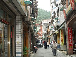
| image_skyline = Pinglin 071208 5.jpg |
|
|
| imagesize = |
|
|
| image_caption = |
|
|
| image_map = Pinglin.png |
|
|
| mapsize = |
|
|
| map_caption = Location of in New Taipei |
|
|
| image_seal = |
|
|
| area_note = |
|
|
| area_magnitude = |
|
|
| area_total_km2 = |
|
|
| population_as_of = |
|
|
| population_total = |
|
|
| population_density_km2 = |
|
|
| timezone = +8 |
|
|
| pushpin_map = |
|
|
| pushpin_label_position = bottom |
|
|
| pushpin_map_caption = |
|
|
| pushpin_mapsize = |
|
|
| latd =024| latm =55| lats =28| latNS=N |
|
|
| longd=121| longm=43| longs=36| longEW=E |
|
|
| postal_code_type = |
|
|
| postal_code = |
|
|
| area_code = |
|
|
| utc_offset = |
|
|
| website = |
|
|
| established_title = |
|
|
| established_date = |
|
|
| footnotes = |
|
|
}} |
|
] |
|
] |
|
|
|
|
| Line 36: |
Line 79: |
|
* |
|
* |
|
{{Taiwan Taipei divisions}} |
|
{{Taiwan Taipei divisions}} |
|
|
|
|
{{coord|24|55|28|N|121|43|36|E|region:TW_type:city_source:kolossus-frwiki|display=title}} |
|
|
|
|
|
|
] |
|
] |
from Taipei City (Xindian MRT)
Bus 923- weekdays: leaves hourly at half-past the hour weekends: on the hour and half-past
Bus Green 12 (綠12)- weekdays: leaves at :15 and :45

 Location of in New Taipei