| Revision as of 20:05, 11 February 2021 editTheImaCow (talk | contribs)Extended confirmed users, Rollbackers84,942 editsm fix ccat← Previous edit | Revision as of 01:24, 12 February 2021 edit undoOgreBot (talk | contribs)Bots, Template editors75,060 editsm Replacing File:The few.jpg with Commons version File:Capel-le-Ferne, Kent.jpg (report errors here)Next edit → | ||
| Line 5: | Line 5: | ||
| |country = England | |country = England | ||
| |official_name= Capel-le-Ferne | |official_name= Capel-le-Ferne | ||
| |static_image_name = |
|static_image_name = Capel-le-Ferne, Kent.jpg | ||
| |static_image_caption=The memorial to ] at Capel-le-Ferne | |static_image_caption=The memorial to ] at Capel-le-Ferne | ||
| |coordinates = {{coord|51.1037|1.2016|display=inline,title}} | |coordinates = {{coord|51.1037|1.2016|display=inline,title}} | ||
Revision as of 01:24, 12 February 2021
For other places named Capel, see Capel (disambiguation).Human settlement in England
| Capel-le-Ferne | |
|---|---|
 The memorial to The Few at Capel-le-Ferne The memorial to The Few at Capel-le-Ferne | |
 | |
| Population | 1,884 (2011) |
| OS grid reference | TR242386 |
| District | |
| Shire county | |
| Region | |
| Country | England |
| Sovereign state | United Kingdom |
| Post town | Folkestone |
| Postcode district | CT18 |
| Dialling code | 01303 |
| Police | Kent |
| Fire | Kent |
| Ambulance | South East Coast |
| UK Parliament | |
| 51°06′13″N 1°12′06″E / 51.1037°N 1.2016°E / 51.1037; 1.2016 | |
Capel-le-Ferne /ˌkeɪpəl lə ˈfɜːrn/ is a village situated near Folkestone, Kent. Its name derives from the phrase "Chapel in the Ferns". It had a population in 2011 of 1,884. It is perched on top of the White Cliffs of Dover.
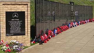
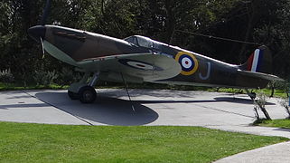
Its foremost attraction is the Battle of Britain Memorial, opened by the Queen Mother on 9 July 1993 and dedicated to those who fought in the battle. The Memorial is built upon part of a former World War II coastal battery (No. 2 and No. 3 guns). The other part of the Coastal Battery is privately held and under restoration. The Channel Tunnel runs underneath the northernmost part of the village.
The village is twinned with the commune of Oye-Plage in the Pas-de-Calais department in France, about 7 miles (12 km) east of Calais.
Transport
The New Dover Road, B2011, that runs between Folkestone and Dover, is the main carriageway. The nearby A20 used by freight and ferry traffic heading for the port of Dover.
Tourism
The cliffs offer a spectacular walking opportunity, towards the East Cliff and Warren Country Park in the direction of Folkestone. Towards Dover, Samphire Hoe can be reached and the area is popular for walking or cycling.
Governance
An electoral ward with the same name exists. This ward includes Hougham Without and at the 2011 census had a population of 2,347.
See also
- RNAS Capel a first world war airship station to the east of the village
- St Mary's Church, Capel-le-Ferne
References
- ^ "Parish population 2011". Neighbourhood Statistics. Office for National Statistics. Archived from the original on 7 October 2015. Retrieved 3 October 2015.
- "Ward population 2011". Retrieved 3 October 2015.
External links
- Official Capel-le-Ferne Parish Council Website
- Official Capel-le-Ferne Website
- Photos of the ancient St Mary's church in Capel-Le-Ferne
Ferne also means "far off', as in, the ferne hills. It was published in Chaucer's epic novel.
This Kent location article is a stub. You can help Misplaced Pages by expanding it. |


