| Revision as of 14:26, 9 November 2021 editQitph (talk | contribs)Extended confirmed users3,686 edits +cat← Previous edit | Revision as of 18:18, 9 April 2022 edit undoSer Amantio di Nicolao (talk | contribs)Autopatrolled, Administrators6,289,672 edits →top: add short descriptionTag: AWBNext edit → | ||
| Line 1: | Line 1: | ||
| {{short description|None}} | |||
| ⚫ | {{further|List of places in Jerusalem}} | ||
| ] | ] | ||
| This is a list of locations in ] sometimes described by the term '']'': | This is a list of locations in ] sometimes described by the term '']'': | ||
| ⚫ | {{further|List of places in Jerusalem}} | ||
| ==Locations in Jordanian municipality (1949–1967)== | ==Locations in Jordanian municipality (1949–1967)== | ||
Revision as of 18:18, 9 April 2022
Further information: List of places in Jerusalem

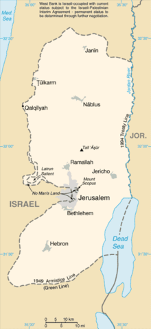
This is a list of locations in Jerusalem sometimes described by the term East Jerusalem:
Locations in Jordanian municipality (1949–1967)
Main article: Jordanian annexation of the West BankThe following locations were included within the borders of the Jordanian municipality in the eastern part of the city between 1949 and 1967:
- American Colony
- The Garden Tomb
- Bab a-Zahara
- Old City of Jerusalem
- Sheikh Jarrah
- Silwan (added in Jordan's 1961 municipal expansion)
- Wadi al-Joz
Locations in expanded Jerusalem municipality (1967–present)
See also: Jerusalem Governorate, East Jerusalem, Green Line (Israel), and Status of Jerusalem
The following locations were included within the borders of the Israeli municipality after its expansion following the 1967 Six-Day War, formalised in the 1980 Israeli Jerusalem Law:
- At-Tur
- Beit Hanina
- Beit Safafa
- Jabel Mukaber
- Jebel Batan al-Hawa
- Kafr 'Aqab
- Ras al-Amud
- Sawahra al-Arbiya
- Sharafat
- Shuafat
- Sur Baher
- Umm Tuba
External links
- B'Tselem – The Separation Barrier
- Large PDF map of the West Bank that shows details of Jerusalem and surroundings