| Revision as of 01:41, 2 April 2020 editSer Amantio di Nicolao (talk | contribs)Autopatrolled, Administrators6,313,418 editsm →External links: add authority controlTag: AWB← Previous edit | Revision as of 08:21, 28 September 2022 edit undoDušan Kreheľ (bot) (talk | contribs)7,016 edits WP:LINKFARMTag: RevertedNext edit → | ||
| Line 16: | Line 16: | ||
| ==External links== | ==External links== | ||
| *https://web.archive.org/web/20071116010355/http://www.statistics.sk/mosmis/eng/run.html | |||
| {{Trebisov District}} | {{Trebisov District}} | ||
Revision as of 08:21, 28 September 2022

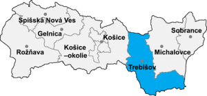
Zbehňov (Template:Lang-hu) is a village and municipality in the Trebišov District in the Košice Region of south-eastern Slovakia.
History
In historical records the village was first mentioned in 1290.
Geography
The village lies at an altitude of 176 metres and covers an area of 5.032 km². It has a population of about 290 people.
Ethnicity
The village is about 73% Slovak and 27% Gypsy.
Facilities
The village has a church and a football pitch.
External links
48°41′N 21°38′E / 48.683°N 21.633°E / 48.683; 21.633
This article relating to the geography of the Trebišov District is a stub. You can help Misplaced Pages by expanding it. |