| Revision as of 23:35, 22 January 2021 editRondolinda (talk | contribs)Extended confirmed users1,482 edits →Education← Previous edit |
Revision as of 16:29, 12 September 2023 edit undoC1MM (talk | contribs)Extended confirmed users12,343 edits Added demographic informationTag: Visual editNext edit → |
| Line 26: |
Line 26: |
|
| image_alt = |
|
| image_alt = |
|
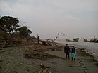
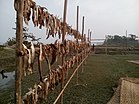
| image_caption = Skyline of Patharghata, Bangladesh |
|
| image_caption = Skyline of Patharghata, Bangladesh |
|
| pushpin_map = Bangladesh |
|
| image_map = Patharghata in Barisal division (Bangladesh).svg |
|
| pushpin_label_position = right |
|
|
| pushpin_map_caption = Location in Bangladesh |
|
|
| coordinates = {{coord|22|{{#expr:.0458*60 round 1}}|N|89|{{#expr:.9689*60 round 1}}|E|type:city_region:BD|display=inline,title}} |
|
| coordinates = {{coord|22|{{#expr:.0458*60 round 1}}|N|89|{{#expr:.9689*60 round 1}}|E|type:city_region:BD|display=inline,title}} |
|
| subdivision_type = ] |
|
| subdivision_type = ] |
| Line 46: |
Line 44: |
|
| elevation_m = |
|
| elevation_m = |
|
| elevation_ft = |
|
| elevation_ft = |
|
| population_total = 134635 |
|
| population_total = 163,927 |
|
| population_as_of = 1991 |
|
| population_as_of = 2011 |
|
| population_footnotes = |
|
| population_footnotes = |
|
| population_density_km2 = auto |
|
| population_density_km2 = auto |
| Line 89: |
Line 87: |
|
|
|
|
|
== Demographics == |
|
== Demographics == |
|
|
|
|
|
{{bar box |
|
|
|title=Religions in Patharghata upazila (2011)<ref name="census2011"/> |
|
|
|titlebar=#Fcd116 |
|
|
|left1=Religion |
|
|
|right1=Percent |
|
|
|float=left |
|
|
|bars= |
|
|
{{bar percent|]|green|89.59}} |
|
|
{{bar percent|]|darkorange|10.40}} |
|
|
{{bar percent|Other or not stated|black|0.01}} |
|
|
}} |
|
|
|
|
|
According to the ], Patharghata Upazila had a population of 163,927 living in 43,085 households. 35,397 (21.59%) were under 10 years of age. Patharghata has a literacy rate (age 7 and over) of 60.5%, compared to the national average of 51.8%, and a sex ratio of 1038 females per 1000 males. 28,521 (17.40%) lived in urban areas.<ref name="community">{{cite web |url=http://203.112.218.65:8008/WebTestApplication/userfiles/Image/PopCen2011/COMMUNITY_BARGUNA.pdf |title=Community Report: Barguna |author=<!--Staff writer(s); no by-line.--> |website=Population & Housing Census 2011 |publisher=Bangladesh Bureau of Statistics |format=PDF |access-date=15 August 2018}}</ref><ref name="2011census">{{cite web |url=http://203.112.218.65:8008/WebTestApplication/userfiles/Image/PopCenZilz2011/Barguna.pdf |title=Bangladesh Population & Housing Census-2011, Zila Report: Barguna |website=] |page=18}}</ref> |
|
|
|
|
As of the ], Patharghata has a population of 134635. Males constitute 50.56% of the population, and females 49.44%. This Upazila's eighteen up population is 68751. Patharghata has an average literacy rate of 66.4% (7+ years), and the national average of 32.4% literate.<ref name="census">{{cite web | accessdate = November 10, 2006 | url = http://www.bangladeshgov.org/mop/ndb/arpc91_v1/tables04.htm | archiveurl = https://web.archive.org/web/20050327072826/http://www.bangladeshgov.org/mop/ndb/arpc91_v1/tables04.htm | archivedate = 2005-03-27 | title = Population Census Wing, BBS.}}</ref> |
|
|
|
|


 Skyline of Patharghata, Bangladesh
