| Revision as of 16:06, 6 November 2005 editDuk (talk | contribs)10,888 edits correction, spelling← Previous edit | Revision as of 22:50, 8 November 2005 edit undoEncMstr (talk | contribs)Edit filter managers, Administrators49,259 editsm fix "timberline" link; add google satellite mapNext edit → | ||
| Line 26: | Line 26: | ||
| The wilderness wraps around the mountain from west to northeast, and borders ski lifts and the ] which occupy the south and east slopes of the mountain. | The wilderness wraps around the mountain from west to northeast, and borders ski lifts and the ] which occupy the south and east slopes of the mountain. | ||
| Numerous hiking trails traverse the area. The best known is the forty-one mile ''Timberline trail'' which circles the mountain. The trail, designated #600 by the Forest service, shares thirteen miles with the ] and alternates above and below the ]. It's accessible from Timberline Lodge |
Numerous hiking trails traverse the area. The best known is the forty-one mile ''Timberline trail'' which circles the mountain. The trail, designated #600 by the Forest service, shares thirteen miles with the ] and alternates above and below the ]. It's accessible from Timberline Lodge and numerous connecting trails. Wilderness permits are free but required to enter the area and can be filled out at ranger stations or at kiosks along trails where they enter the wilderness. | ||
| Wilderness areas do not allow ] or ] equipment including ]s. Although ] and ] are allowed with proper permit, no roads or buildings are constructed and there is also no ] or ], in compliance with the 1964 ]. Wilderness areas within ]s and ] areas also allow ] in season. | Wilderness areas do not allow ] or ] equipment including ]s. Although ] and ] are allowed with proper permit, no roads or buildings are constructed and there is also no ] or ], in compliance with the 1964 ]. Wilderness areas within ]s and ] areas also allow ] in season. | ||
| Line 44: | Line 44: | ||
| * | * | ||
| * | * | ||
| * | |||
| ] | ] | ||
Revision as of 22:50, 8 November 2005
| Mount Hood Wilderness | |
| File:Map of USA Locator Mount Hood Wilderness.PNG | |
| Designation | Wilderness |
| Location | Oregon, United States |
| Nearest City | Portland, Oregon |
| Coordinates | 45°23′N 121°45′W / 45.383°N 121.750°W / 45.383; -121.750 |
| Area | 47,160 acres (190 km²) |
| Date of Establishment | 1964 |
| Governing Body | U.S. Forest Service |
| IUCN category | Ib (Wilderness) |
The Mount Hood Wilderness is a protected wilderness area inside the Mount Hood National Forest. The area, about 47,000 acres, includes the mountain's peak and upper slopes, and ranges from temperate rain forests at the lower elevations, to glaciers and rock covered ridges at higher elevations.
The wilderness wraps around the mountain from west to northeast, and borders ski lifts and the Timberline lodge which occupy the south and east slopes of the mountain.
Numerous hiking trails traverse the area. The best known is the forty-one mile Timberline trail which circles the mountain. The trail, designated #600 by the Forest service, shares thirteen miles with the Pacific Crest Trail and alternates above and below the timberline. It's accessible from Timberline Lodge and numerous connecting trails. Wilderness permits are free but required to enter the area and can be filled out at ranger stations or at kiosks along trails where they enter the wilderness.
Wilderness areas do not allow motorized or mechanical equipment including bicycles. Although camping and fishing are allowed with proper permit, no roads or buildings are constructed and there is also no logging or mining, in compliance with the 1964 Wilderness Act. Wilderness areas within National Forests and Bureau of Land Management areas also allow hunting in season.
Images
-
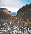
 A Glaciated valley on the west side of the mountain.
-
 Temperate rain forests on the west side of the mountain.
-
 The head waters of the Sandy River.
-
 Ramona Falls
External links
This Oregon location article is a stub. You can help Misplaced Pages by expanding it. |