| Revision as of 08:38, 27 April 2010 edit124.253.116.223 (talk) →References← Previous edit | Revision as of 09:53, 27 April 2010 edit undoCrusoe8181 (talk | contribs)Autopatrolled, Pending changes reviewers, Rollbackers84,633 edits rmv fallingrain refNext edit → | ||
| Line 25: | Line 25: | ||
| ==Geography == | ==Geography == | ||
| The town is situated at approximately 325 km from ], 120 km from ] and 1400 km from ]. It is in the North-West part of India; a few hundred kilometres south of ] and to the west of the Himalayan foothills of ] and ]. On a clear day, the snow clad peaks of the ] range is visible in the distant horizon. The Banga ] station is located on the ] City/Jaijon Doaba Line of the Northern Railway at 13 km from Nawanshahar and 44 km from Jalandhar. It is also linked by road with Nawanshahar on one side and with ] on the ] on the other side. It is located on the main ]/] and ]/] route. | |||
| ] | ] | ||
| Line 44: | Line 44: | ||
| ==References== | ==References== | ||
| {{Reflist}} | {{Reflist}} | ||
| vill: | |||
| ==External links== | ==External links== | ||
Revision as of 09:53, 27 April 2010
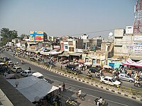
Template:Infobox Indian jurisdiction Banga is a town and a Municipal council in the Shahid Bhagat Singh Nagar district of Punjab, India. It is located on the Punjab Plain. In 1961, its population was 10,212 which grew to 11,885 in 1971. It is currently estimated to have a population of about 20,000 and is classified as a Class 2 Municipality.
Geography
The town is situated at approximately 325 km from New Delhi, 120 km from Amritsar and 1400 km from Mumbai. It is in the North-West part of India; a few hundred kilometres south of Kashmir and to the west of the Himalayan foothills of Punjab and Himachal Pradesh. On a clear day, the snow clad peaks of the Dhauladhar range is visible in the distant horizon. The Banga Railway station is located on the Jalandhar City/Jaijon Doaba Line of the Northern Railway at 13 km from Nawanshahar and 44 km from Jalandhar. It is also linked by road with Nawanshahar on one side and with Phagwara on the GT Road on the other side. It is located on the main Amritsar/Chandigarh and Amritsar/Anandpur Sahib route.

Demographics
As of 2001 India census, Banga had a population of 18,892 of which 52% were men. Banga has an average literacy rate of 75%, higher than the national average of 59.5%; with 79% of the males and 73% of females literate. 10% of the population is under the age of six.
Health facilities
There is a Civil hospital on the Main road and Karan Hospital near Bus Stand. Close to the town is the Dhahan Kaleran Hospital.
Notable people
- Freedom fighter, Bhagat Singh, after whom the district is named was born nearby at the village of Khatkar Kalan.
Villages near Banga
Moranwali, Khatkar Kalan, Thandian. banga village bhadur ke ludhiana Lakhpur, Malupota, Ladhana Jhikka
References
External links
| Cities and towns in Shaheed Bhagat Singh Nagar district | |
|---|---|
| Shaheed Bhagat Singh Nagar | |
| Other districts | |
This article about a location in the Indian state of Punjab is a stub. You can help Misplaced Pages by expanding it. |