Browse history interactively ← Previous edit Next edit → Content deleted Content addedVisual Wikitext Inline
Revision as of 15:30, 16 January 2011 edit EmausBot talk | contribs )Bots , Template editors 2,859,937 editsm r2.6.4) (robot Adding: az:Zaozyorsk ← Previous edit Revision as of 21:06, 24 March 2011 edit undo Rich Farmbrough talk | contribs )Edit filter managers , Autopatrolled , Extended confirmed users , File movers , Pending changes reviewers , Rollbackers , Template editors 1,725,545 editsm Change infobox census labels using AWB Next edit →
Line 61:
Line 61:
|area_km2=
|area_km2=
|area_km2_ref=
|area_km2_ref=
|pop_census=12856
|pop_2002census =12856
|pop_2002census_rank=
|pop_census_rank=
|pop_2002census_ref=<ref name="PopCensus">{{ru-pop-ref|2002Census}}</ref>
|pop_density=
|pop_density=
|pop_density_as_of=
|pop_density_as_of=
Revision as of 21:06, 24 March 2011
Place in Murmansk Oblast, Russia
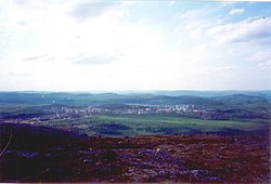
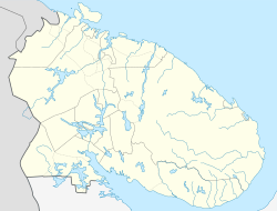
Zaozyorsk (Template:Lang-ru ), formerly called Murmansk-150 (Му́рманск-150), is a closed town in Murmansk Oblast , Russia . Population: 12,687 (2002 Census ).
Zaozyorsk was originally formed in 1958 as a settlement called Zaozerny Village. The aim of the settlement was to be a base for a nuclear underwater fleet that was to protect Soviet's northern sea border. The base was renamed in 1959 as Zapadnaya Litsa .
Map of Northern Fleet bases References
"Об исчислении времени" . Официальный интернет-портал правовой информации (in Russian). 3 June 2011. Retrieved 19 January 2019.http://www.russianpost.ru/PostOfficeFindInterface/FindOPSByPostOfficeID.aspx?index=184310
^ Federal State Statistics Service (21 May 2004). Численность населения России, субъектов Российской Федерации в составе федеральных округов, районов, городских поселений, сельских населённых пунктов – районных центров и сельских населённых пунктов с населением 3 тысячи и более человек Всероссийская перепись населения 2002 года (in Russian).help page ).
Links to related articles
Categories :
Text is available under the Creative Commons Attribution-ShareAlike License. Additional terms may apply.
**DISCLAIMER** We are not affiliated with Wikipedia, and Cloudflare.
The information presented on this site is for general informational purposes only and does not constitute medical advice.
You should always have a personal consultation with a healthcare professional before making changes to your diet, medication, or exercise routine.
AI helps with the correspondence in our chat.
We participate in an affiliate program. If you buy something through a link, we may earn a commission 💕
↑
 Overview of Zaozyorsk
 Flag
Flag Coat of arms

