| Revision as of 15:49, 1 September 2011 editEzhiki (talk | contribs)Autopatrolled, Administrators165,314 edits +2010 Census preliminary results and some copyed← Previous edit | Revision as of 20:38, 27 December 2011 edit undoRich Farmbrough (talk | contribs)Edit filter managers, Autopatrolled, Extended confirmed users, File movers, Pending changes reviewers, Rollbackers, Template editors1,725,545 editsm 2010Census -> 2010Census_prelim using AWBNext edit → | ||
| Line 51: | Line 51: | ||
| |area_km2_ref= | |area_km2_ref= | ||
| |pop_2010census=11206 | |pop_2010census=11206 | ||
| |pop_2010census_ref=<ref name="2010Census">{{ru-pop-ref| |
|pop_2010census_ref=<ref name="2010Census">{{ru-pop-ref|2010Census_prelim}}</ref> | ||
| |pop_2002census=12687 | |pop_2002census=12687 | ||
| |pop_2002census_ref=<ref name="PopCensus">{{ru-pop-ref|2002Census}}</ref> | |pop_2002census_ref=<ref name="PopCensus">{{ru-pop-ref|2002Census}}</ref> | ||
| Line 90: | Line 90: | ||
| ] | ] | ||
| ] | ] | ||
| ⚫ | {{MurmanskOblast-geo-stub}} | ||
| ] | ] | ||
| Line 108: | Line 111: | ||
| ] | ] | ||
| ] | ] | ||
| ⚫ | {{MurmanskOblast-geo-stub}} | ||
Revision as of 20:38, 27 December 2011
Town in Murmansk Oblast, Russia| Zaozyorsk Заозёрск | |
|---|---|
| Town | |
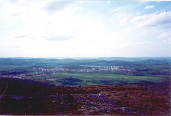
 Overview of Zaozyorsk Overview of Zaozyorsk | |
 Flag Flag Coat of arms Coat of arms | |
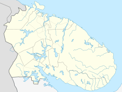
| Location of Zaozyorsk | |
  | |
| Coordinates: 69°24′N 32°27′E / 69.400°N 32.450°E / 69.400; 32.450 | |
| Country | Russia |
| Federal subject | Murmansk Oblast |
| Founded | 1958 |
| Government | |
| • Mayor | Pyotr Bogdanovich |
| Elevation | 60 m (200 ft) |
| Population | |
| • Total | 11,206 |
| Municipal status | |
| • Urban okrug | Zaozyorsk Urban Okrug |
| Time zone | UTC+3 (MSK |
| Postal code(s) | 184310 |
| Dialing code(s) | +7 81556 |
| OKTMO ID | 47733000001 |
| Website | www |

Zaozyorsk (Template:Lang-ru), formerly called Murmansk-150 (Му́рманск-150), is a closed town in Murmansk Oblast, Russia. Population: 11,206 (2010 Census); 12,687 (2002 Census).
Zaozyorsk was originally formed in 1958 to serve as a base for a nuclear underwater fleet that was to protect Soviet's northern sea border. The base was renamed Zapadnaya Litsa in 1959.
References
- ^ Invalid reference parameter Cite error: The named reference "2010Census" was defined multiple times with different content (see the help page).
- "Об исчислении времени". Официальный интернет-портал правовой информации (in Russian). 3 June 2011. Retrieved 19 January 2019.
- Local post office http://www.russianpost.ru/PostOfficeFindInterface/FindOPSByPostOfficeID.aspx?index=184310
- ^ Federal State Statistics Service (21 May 2004). Численность населения России, субъектов Российской Федерации в составе федеральных округов, районов, городских поселений, сельских населённых пунктов – районных центров и сельских населённых пунктов с населением 3 тысячи и более человек [Population of Russia, Its Federal Districts, Federal Subjects, Districts, Urban Localities, Rural Localities—Administrative Centers, and Rural Localities with Population of Over 3,000] (XLS). Всероссийская перепись населения 2002 года (in Russian). Cite error: The named reference "PopCensus" was defined multiple times with different content (see the help page).
| Administrative divisions of Murmansk Oblast | |
|---|---|
| Administrative center: Murmansk • Rural localities | |
| Administrative districts | |
| Closed administrative-territorial formations | |
| Cities and towns (all levels) | |
| Urban-type settlements | |
This Murmansk Oblast location article is a stub. You can help Misplaced Pages by expanding it. |