| Revision as of 21:13, 18 June 2012 editFoCuSandLeArN (talk | contribs)77,866 edits added infobox← Previous edit | Revision as of 21:19, 18 June 2012 edit undoFoCuSandLeArN (talk | contribs)77,866 edits added infobox detailsNext edit → | ||
| Line 2: | Line 2: | ||
| {{Infobox settlement | {{Infobox settlement | ||
| <!-- See Template:Infobox settlement for additional fields and descriptions --> | <!-- See Template:Infobox settlement for additional fields and descriptions --> | ||
| | name = | | name =Zapolyarny | ||
| | native_name = | | native_name =Заполярный | ||
| | native_name_lang = |
| native_name_lang = ru | ||
| | settlement_type = | | settlement_type = | ||
| | image_skyline = | | image_skyline = | ||
| | image_alt = | | image_alt = | ||
| | image_caption = | | image_caption = | ||
| | image_flag = | | image_flag =Flag of Zapolyarny (Murmansk oblast).png | ||
| | flag_alt = | | flag_alt = | ||
| | image_seal = | | image_seal = | ||
| | seal_alt = | | seal_alt = | ||
| | image_shield = | | image_shield =Coat of Arms of Zapolyarny (Murmansk oblast).jpg | ||
| | shield_alt = | | shield_alt = | ||
| | nickname = | | nickname = | ||
| | motto = | | motto = | ||
| | image_map = | | image_map =Outline Map of Murmansk region.svg | ||
| | map_alt = | | map_alt = | ||
| | map_caption = | | map_caption = | ||
| Line 24: | Line 24: | ||
| | pushpin_map_alt = | | pushpin_map_alt = | ||
| | pushpin_map_caption = | | pushpin_map_caption = | ||
| | latd = |latm = |lats = |latNS = | | latd = 69 |latm =25 |lats = 0 |latNS =N | ||
| | longd = |longm = |longs = |longEW = | | longd = 30 |longm = 48 |longs = 0 |longEW =E | ||
| | coor_pinpoint = | | coor_pinpoint = | ||
| | coordinates_type = | | coordinates_type = | ||
| Line 39: | Line 39: | ||
| | subdivision_name3 = | | subdivision_name3 = | ||
| | established_title = | | established_title = | ||
| | established_date = | | established_date =1963 | ||
| | founder = | | founder = | ||
| | seat_type = | | seat_type = | ||
| Line 61: | Line 61: | ||
| | area_blank2_title = | | area_blank2_title = | ||
| <!-- square kilometers --> | <!-- square kilometers --> | ||
| | area_total_km2 = | | area_total_km2 = 6 | ||
| | area_land_km2 = | | area_land_km2 = | ||
| | area_water_km2 = | | area_water_km2 = | ||
| Line 92: | Line 92: | ||
| | dimensions_footnotes = | | dimensions_footnotes = | ||
| | elevation_footnotes = | | elevation_footnotes = | ||
| | elevation_m = | | elevation_m =116 | ||
| | population_footnotes = | | population_footnotes = | ||
| | population_total = | | population_total =15835 | ||
| | population_as_of = | | population_as_of =2010 | ||
| | population_density_km2 = auto | | population_density_km2 = auto | ||
| | population_demonym = | | population_demonym =zapolyarnentsy, zapolyarnenets | ||
| | population_note = | | population_note = | ||
| | timezone1 = | | timezone1 = | ||
| | utc_offset1 = | | utc_offset1 =+4 | ||
| | timezone1_DST = | | timezone1_DST = | ||
| | utc_offset1_DST = | | utc_offset1_DST = | ||
| | postal_code_type = | | postal_code_type = | ||
| | postal_code = | | postal_code =184 430 | ||
| | area_code_type = | | area_code_type = | ||
| | area_code = | | area_code =+7 81554 | ||
| | iso_code = | | iso_code = | ||
| | website = |
| website = {{Official site|http://www.zapadmin.ru/}} | ||
| | footnotes = | | footnotes = | ||
| }} | }} | ||
Revision as of 21:19, 18 June 2012
You can help expand this article with text translated from the corresponding article in Russian. Click for important translation instructions.
|
| Zapolyarny Заполярный | |
|---|---|
 Flag Flag Coat of arms Coat of arms | |
 | |
| Area | |
| • Total | 6 km (2 sq mi) |
| Elevation | 116 m (381 ft) |
| Population | |
| • Total | 15,835 |
| • Density | 2,600/km (6,800/sq mi) |
| Demonym(s) | zapolyarnentsy, zapolyarnenets |
| Time zone | UTC+4 |
| Area code | +7 81554 |
| Website | Official website |
69°25′N 30°48′E / 69.417°N 30.800°E / 69.417; 30.800

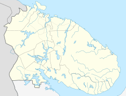
Zapolyarny (Template:Lang-ru) is a town in Pechengsky District of Murmansk Oblast, Russia, located on the Kola Peninsula, 10 kilometers (6.2 mi) south of the Kola Superdeep Borehole project. Population: 18,640 (2002 Census); 23,564 (1989 Soviet census).
The area where the town is located belonged to Finland in 1920–1944. It was founded in 1956 as Zhdanovsk (Жда́новск) and was granted work settlement status and later given its present name.
On February 1, 1963, by the Decree by the Presidium of the Supreme Soviet of the RSFSR, Zapolyarny was elevated in status to that of a town of district significance.
Gallery
References
Notes
- Federal State Statistics Service (21 May 2004). Численность населения России, субъектов Российской Федерации в составе федеральных округов, районов, городских поселений, сельских населённых пунктов – районных центров и сельских населённых пунктов с населением 3 тысячи и более человек [Population of Russia, Its Federal Districts, Federal Subjects, Districts, Urban Localities, Rural Localities—Administrative Centers, and Rural Localities with Population of Over 3,000] (XLS). Всероссийская перепись населения 2002 года (in Russian).
- Всесоюзная перепись населения 1989 г. Численность наличного населения союзных и автономных республик, автономных областей и округов, краёв, областей, районов, городских поселений и сёл-райцентров [All Union Population Census of 1989: Present Population of Union and Autonomous Republics, Autonomous Oblasts and Okrugs, Krais, Oblasts, Districts, Urban Settlements, and Villages Serving as District Administrative Centers]. Всесоюзная перепись населения 1989 года (in Russian). Институт демографии Национального исследовательского университета: Высшая школа экономики . 1989 – via Demoscope Weekly.
- Administrative-Territorial Division of Murmansk Oblast, p. 56
Sources
- Архивный отдел Администрации Мурманской области. Государственный Архив Мурманской области. (1995). Административно-территориальное деление Мурманской области (1920–1993 гг.). Справочник. Мурманск: Мурманское издательско-полиграфическое предприятие "Север".
| Administrative divisions of Murmansk Oblast | |
|---|---|
| Administrative center: Murmansk • Rural localities | |
| Administrative districts | |
| Closed administrative-territorial formations | |
| Cities and towns (all levels) | |
| Urban-type settlements | |
This Murmansk Oblast location article is a stub. You can help Misplaced Pages by expanding it. |

