| Revision as of 03:14, 29 July 2006 editElonka (talk | contribs)Autopatrolled, Administrators70,960 edits Voivodeship cleanup, per Wikipedia_talk:WikiProject Geography of Poland, and stub sorting using AWB← Previous edit | Revision as of 17:25, 28 August 2006 edit undoThe Anomebot2 (talk | contribs)Bots, Extended confirmed users1,043,658 edits Adding geodata...Next edit → | ||
| Line 19: | Line 19: | ||
| * | * | ||
| ] | ] | ||
| ⚫ | {{Lubusz-geo-stub}} | ||
| {{coor title dm|52|03|N|15|05|E|region:PL_type:city}} | |||
| ] | ] | ||
| Line 28: | Line 32: | ||
| ] | ] | ||
| ] | ] | ||
| ⚫ | {{Lubusz-geo-stub}} | ||
Revision as of 17:25, 28 August 2006

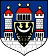
Krosno Odrzańskie (German: Crossen an der Oder) is a city in Western Poland with 12,500 inhabitants (2002), situated in the Lubusz Voivodeship (since 1999), previously part of Zielona Góra Voivodeship (1975-1998). It is the capital of Krosno County. (Note: Do not confuse this with Krosno in the Subcarpathian Voivodeship.)
Crosno was first mentioned in 1005 and was chartered as a town in 1201. Due to its important strategic location it played an important role in the protective system at the western borders of Poland during the 11th to 13th centuries. A stone castle was built by the Silesian Piasts in the 13th century. When the Piast dynasty had become extinct in 1476, the area became part of Bohemia in 1482. After the Partitions of Poland it became part of Prussia (Lower Silesia) and remained so until 1945. Today, Krosno Odrzańskie is the capital of the Krośnieński district.
Noted natives
- Georg Wenzeslaus von Knobelsdorff-Prussian artist.(Wasn't called Krosno Odrzańskie then)
- Tomasz Kuszczak-Poland national football team
- Aneta Pastuszka-Olympic canoer
External links

This Lubusz Voivodeship location article is a stub. You can help Misplaced Pages by expanding it. |
52°03′N 15°05′E / 52.050°N 15.083°E / 52.050; 15.083
Categories: