This is an old revision of this page, as edited by 71.120.98.188 (talk) at 20:10, 8 August 2009. The present address (URL) is a permanent link to this revision, which may differ significantly from the current revision.
Revision as of 20:10, 8 August 2009 by 71.120.98.188 (talk)(diff) ← Previous revision | Latest revision (diff) | Newer revision → (diff)| The neutrality of this article is disputed. Relevant discussion may be found on the talk page. Please do not remove this message until conditions to do so are met. (December 2007) (Learn how and when to remove this message) |
| This article possibly contains original research. Please improve it by verifying the claims made and adding inline citations. Statements consisting only of original research should be removed. (September 2007) (Learn how and when to remove this message) |

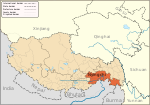
Mêdog County, (Tibetan: ཀོང་པོ་རྒྱ་མདའ་རྫོང་ Wylie me tog rdzong; Chinese: 墨脱县; Pinyin: Mòtuō Xiàn) is a county of the Nyingtri Prefecture in the Tibet Autonomous Region of People's Republic of China. Its southern part is now actually occupied by India and the border dispute between China and India has not been settled yet.
Geography
Medog County or ( Metok )is located in the southeast of the Tibet Autonomous Region and at the lower branch of Yarlung Zangbo River. Medog County covers an area of 30,553 square kilometres. The average altitude of the county is 1200 metres above sea level.Metok county is also called Pemako.
Economy and wildlife
Farming is the main industry in Medog County. It is abundant with paddy, soybean, cotton and gingeli, etc. Hairy deerhorn, gastrodia tuber, muskiness, and hedgehog hydnum, etc. are special products of the area.
The Medog National Animal and Plant Reserve Area is in the county. It has more than 3,000 species of plants, 42 species of rare wild animals that under special State protection, and over a thousand of hexapod species.
Demography
Medog county has a population of 9,200, and most people who live in the county are of Monpa ethnic minority and Lhoba ethnic group, This place is also called Pemako and it is one of Tibet's sacred place.People here call themselve pemakopa and speak Tsangla language closely related to that of sharchokpas in eastern Bhutan.They practice Nyingma tradition of tibetan buddhism.
| County-level divisions of Tibet Autonomous Region | |||||||||||||
|---|---|---|---|---|---|---|---|---|---|---|---|---|---|
| Lhasa (capital) | |||||||||||||
| Prefecture-level cities |
| ||||||||||||
| Prefecture |
| ||||||||||||
| ** Southern portions of these counties are claimed by the People's Republic of China as part of the South Tibet area, but are administered by India. | |||||||||||||
| Nyingchi | ||
|---|---|---|
| District | Bayi |  |
| Counties | ||
| Towns and villages | ||
| Geography | ||
| Culture | ||
| Sciences & Business | ||
29°29′N 95°30′E / 29.483°N 95.500°E / 29.483; 95.500
This Nyingchi, Tibet location article is a stub. You can help Misplaced Pages by expanding it. |