This is an old revision of this page, as edited by MirkoS18 (talk | contribs) at 10:19, 14 April 2021 (→External links). The present address (URL) is a permanent link to this revision, which may differ significantly from the current revision.
Revision as of 10:19, 14 April 2021 by MirkoS18 (talk | contribs) (→External links)(diff) ← Previous revision | Latest revision (diff) | Newer revision → (diff) Municipality in Slavonia, Croatia| Erdut Ердут (Serbian) | |
|---|---|
| Municipality | |
| Municipality of Erdut Općina Erdut | |
        Villages of the Erdut Municipality Villages of the Erdut Municipality | |
 Coat of arms Coat of arms | |
 | |
| Coordinates: 45°32′N 19°04′E / 45.533°N 19.067°E / 45.533; 19.067 | |
| Country | |
| Region | Slavonia (Podunavlje) |
| County | |
| Government | |
| • Municipal mayor | Jugoslav Vesić (SDSS) |
| Area | |
| • Total | 159.16 km (61.45 sq mi) |
| Elevation | 158 m (518 ft) |
| Population | |
| • Total | 7,308 |
| • Density | 46/km (120/sq mi) |
| Time zone | UTC+1 (CET) |
| • Summer (DST) | UTC+2 (CEST) |
| Postal codes | 31204 Bijelo Brdo 31205 Aljmaš 31206 Erdut 31226 Dalj |
| Area code | 031 |
| Official languages | Croatian, Serbian |
| Website | www |
Erdut (Croatian pronunciation: [ěrduːt]; Serbian Cyrillic: Ердут; Template:Lang-hu [ˈɛrdøːd], Template:Lang-de) is a village and a municipality in eastern Croatia, located some 37 km east of the major city of Osijek, lying on the border with neighbouring Serbia. The village of Erdut is the third largest in the municipality, after Dalj and Bijelo Brdo. The municipality is part of the Osijek-Baranja County in eastern Slavonia. The municipal center is in the largest village of Dalj.
Name and languages
The name Erdut comes from the local Hungarian name (Erdőd) meaning "forest road". In other languages, the village in German is known as Erdung and in Serbian as Ердут.
Due to the local minority population, the Erdut municipality prescribe the use of not only Croatian as the official language, but the Serbian language and Serbian Cyrillic alphabet as well.
Geography
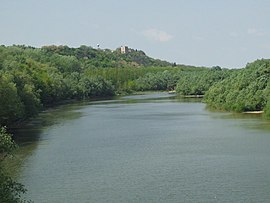
The municipality has a total area of 158 km (61 sq mi) and is the largest member municipality of Joint Council of Municipalities. The Drava (5.6 km) and Danube (34.825 km) rivers flow through the municipality. The territory of the municipality is completely flat very fertile black soil. The elevation of the village of Erdut is 158 m. It is located at the end of the D213 road near border crossing with Serbia. The railway station is located in Novi Erdut (New Erdut) hamlet, about 1 km south of the village, on the Vukovar-Erdut-Bogojevo (Serbia) railway.
History
The settlement was first mentioned in 1335 under the Hungarian name Erdöd and then as a city in 1472. It was successively ruled by Ottoman Empire, Austrian Empire, Austria-Hungary, Kingdom of Yugoslavia, Independent State of Croatia and Yugoslavia.
Croatian War of Independence
Main article: Erdut massacreWhen Croatia declared independence from Yugoslavia in 1991, eastern Slavonia was soon overrun by the Yugoslav People's Army and Serb paramilitaries, led by the notorious warlord, Željko Ražnatović known by the name Arkan. The battle for Erdut quickly ended that summer as the entire Croatian population was expelled or killed along with other minorities including Czechs, Germans, Hungarians, Ruthenians and Ukrainians in an act of ethnic cleansing. Their homes were soon occupied by other Serbs. Many buildings and homes were destroyed, including the Roman Catholic Church.
Arkan soon set up a training camp for his Serb Volunteer Guard in Erdut, which became headquarters until the end of the war, when Croatian forces returned according to a peaceful Basic Agreement on the Region of Eastern Slavonia, Baranja and Western Sirmium.
Erdut Agreement
Main article: Erdut AgreementOn November 12, 1995, officials signed what is commonly called the Erdut Agreement in which the part of eastern Slavonia still occupied by Serbs would be integrated back into Croatia, gradually allowing some of the exiled refugees to return to their homes. This agreement was the basis for the establishment of Joint Council of Municipalities. Erdut has been under Croatian control since 1998.
Demographics
| Year | Pop. | ±% |
|---|---|---|
| 1880 | 9,421 | — |
| 1890 | 10,451 | +10.9% |
| 1900 | 10,904 | +4.3% |
| 1910 | 11,373 | +4.3% |
| 1921 | 10,543 | −7.3% |
| 1931 | 10,976 | +4.1% |
| 1948 | 10,177 | −7.3% |
| 1953 | 10,324 | +1.4% |
| 1961 | 11,440 | +10.8% |
| 1971 | 11,353 | −0.8% |
| 1981 | 11,035 | −2.8% |
| 1991 | 10,197 | −7.6% |
| 2001 | 8,417 | −17.5% |
| 2011 | 7,308 | −13.2% |
| Source: Naselja i stanovništvo Republike Hrvatske 1857–2001, DZS, Zagreb, 2005 | ||
Population
According to the 2011 census, the municipality has a population is 7,308. The municipal population consists of Serbs (55%), Croats (38%) and Hungarians (5%).
There are 4 settlements in municipality:
| Settlement | population |
|---|---|
| Aljmaš | 610 |
| Bijelo Brdo | 1,976 |
| Dalj | 3,952 |
| Erdut | 818 |
Religion
Dalj is seat of the Eparchy of Osječko polje and Baranja of the Serbian Orthodox Church.
Politics
Joint Council of Municipalities
The Municipality of Erdut is one of seven Serb majority member municipalities within the Joint Council of Municipalities, inter-municipal sui generis organization of ethnic Serb community in eastern Croatia established on the basis of Erdut Agreement. As Serb community constitute majority of the population of the municipality it is represented by 2 delegated Councillors at the Assembly of the Joint Council of Municipalities, double the number of Councilors to the number from Serb minority municipalities in Eastern Croatia.
Municipality government
The municipality assembly is composed of 13 representatives. As of 2009, the member parties/lists are:
| Party | Number of votes | Number of seats | |
|---|---|---|---|
| Independent Democratic Serb Party | 1.688 | 8 | |
| Croatian Democratic Alliance of Slavonia and Baranja | 843 | 4 | |
| Croatian Democratic Union | 380 | 1 | |
| Croatian Peasant Party | 157 | 0 | |
| Social Democratic Party of Croatia | 149 | 0 | |
| Independent list-Stevo Vujaklija | 129 | 0 | |
| Independent list-Mijo Nemet | 67 | 0 |
Economy
Erdut development index is between 50-76% of the Croatian average, and is underdeveloped municipality which is statistically classified as the First Category Area of Special State Concern by the Government of Croatia.
Culture
| This section is written like a travel guide. Please help improve the section by introducing an encyclopedic style or move the content to Wikivoyage. (March 2014) |
Points of Interest


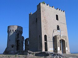
The municipality is home of Eparchy of Osječko polje and Baranja, and there is also Erdut Castle.
Notable natives and residents
- Milutin Milanković, born in Dalj
- Anton Tittjung, World War II concentration camp guard, who was stripped of his U.S. citizenship for his wartime activities.
See also
- Erdut Agreement
- Osijek-Baranja County
- Slavonia
- Joint Council of Municipalities
- Cultural and Scientific Center "Milutin Milanković"
- High School Dalj
- List of Croatian municipalities with minority languages in official use
References
- ^ Government of Croatia (October 2013). "Peto izvješće Republike Hrvatske o primjeni Europske povelje o regionalnim ili manjinskim jezicima" (PDF) (in Croatian). Council of Europe. p. 36. Retrieved 30 November 2016.
- "Općine na područjima posebne državne skrbi Republike Hrvatske" (PDF). Croatian Chamber of Economy. Retrieved 15 April 2020.
- ^ "Erdut | Općina Erdut". Opcina-erdut.hr. Retrieved 2014-01-31.
- Izvješće o provođenju ustavnog zakona o pravima nacionalnih manjina i o utošku sredstava osiguranih u državnom proračunu Republike Hrvatske za 2008. godinu za potrebe nacionalnih manjina, Zagreb, 2009.
- ^ "Povrsina, stanovnistvo, naseljenost" (PDF). Opcina-erdut.hr. Archived from the original (PDF) on 2013-06-22. Retrieved 2014-02-21.
- "Transcript". Slobodan-milosevic.org. 2004-01-13. Retrieved 2014-01-31.
- ^ The New York Times; May 10, 1992
- ^ "Peace Agreements Digital Collection" (PDF). Usip.org. Archived from the original (PDF) on 2012-12-25. Retrieved 2014-02-21.
- "The Thorny Issue of Ethnic Autonomy in Croatia" (PDF). Ecmi.de. Archived from the original (PDF) on 2011-03-02. Retrieved 2014-02-21.
- "Population by Ethnicity, by Towns/Municipalities, 2011 Census: County of Osijek-Baranja". Census of Population, Households and Dwellings 2011. Zagreb: Croatian Bureau of Statistics. December 2012.
- "Population by Age and Sex, by Settlements, 2011 Census: Erdut". Census of Population, Households and Dwellings 2011. Zagreb: Croatian Bureau of Statistics. December 2012.
- "Konstituisan 6. saziv Zajedničkog veća opština l" (in Serbian). Zagreb: Privrednik. 1 August 2017.
- "Informacija o rezultatima izbora članova predstavničkih tijela jedinica lokalne i područne (regionalne) samouprave" (PDF). Retrieved 2013-04-03.
- "Odluka o razvrstavanju jedinica lokalne i područne (regionalne) samouprave prema stupnju razvijenosti" (in Croatian). 27 December 2013. Retrieved 12 October 2015.
- Lovrinčević, Željko; Davor, Mikulić; Budak, Jelena (June 2004). "AREAS OF SPECIAL STATE CONCERN IN CROATIA- REGIONAL DEVELOPMENT DIFFERENCES AND THE DEMOGRAPHIC AND EDUCATIONAL CHARACTERISTICS". Ekonomski pregled, Vol.55 No.5-6. Archived from the original on 18 August 2018. Retrieved 25 August 2018.
External links
- Official website
 (in Croatian)
| Places adjacent to Erdut | ||||||||||||||||
|---|---|---|---|---|---|---|---|---|---|---|---|---|---|---|---|---|
| ||||||||||||||||
| Erdut Municipality | ||
|---|---|---|
| Settlements by pupulation |  | |
| Attractions | ||
| Traffic routes | ||
| History | ||
| Neighboring municipalities and cities | ||
| Subdivisions of Osijek-Baranja County | ||
|---|---|---|
| Cities and towns |  | |
| Municipalities |
| |
