This is an old revision of this page, as edited by Ο Ροζ Πάνθηρας (talk | contribs) at 22:04, 3 August 2022 (Undid revision 1102152003 by Local hero (talk)). The present address (URL) is a permanent link to this revision, which may differ significantly from the current revision.
Revision as of 22:04, 3 August 2022 by Ο Ροζ Πάνθηρας (talk | contribs) (Undid revision 1102152003 by Local hero (talk))(diff) ← Previous revision | Latest revision (diff) | Newer revision → (diff)| Dojran Lake Дојранско Езеро Λίμνη Δοϊράνη | |
|---|---|
 | |
 Дојранско Езеро Λίμνη Δοϊράνη | |
| Location | Region of Macedonia |
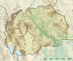
| Coordinates | 41°13′N 22°45′E / 41.217°N 22.750°E / 41.217; 22.750 |
| Basin countries | Greece, North Macedonia |
| Max. length | 8.9 km (5.5 mi) |
| Max. width | 7.1 km (4.4 mi) |
| Surface area | 43.1 km (16.6 sq mi) |
| Max. depth | 10 m (33 ft) |
| Surface elevation | 148 m (486 ft) |
| Ramsar Wetland | |
| Official name | Dojran Lake |
| Designated | 2 August 2007 |
| Reference no. | 1735 |
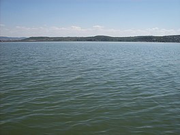
Doiran Lake (Template:Lang-mk, Dojransko Ezero; Template:Lang-el, Límni Dhoïráni), also spelled Dojran Lake is a lake with an area of 43.1 km (16.6 sq mi) shared between North Macedonia (27.3 km, 10.5 sq mi) and Greece (15.8 km, 6.1 sq mi).
To the west is the city of Nov Dojran (Нов Дојран), to the east the village of Mouries, to the north the mountain Belasica/Beles and to the south the Greek town of Doirani. The lake has a rounded shape, a maximum depth of 10 m (33 ft) and a north-to-south length of 8.9 km (5.5 mi) and is 7.1 km (4.4 mi) at its widest, making it the third largest lake partially in North Macedonia after Lake Ohrid and Lake Prespa.
History
The lake was on the southern line of the Macedonian front during World War I, and its southern shore became the site of the various battles between allied troops and Bulgarian troops in 1916, 1917 and 1918. A monument to one of the battles and two cemeteries for Greek and British troops stand on a hill a few hundred metres south of the lake. It was designed by Sir Robert Lorimer.

Ecology
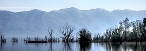
The lake is shallow and eutrophic, with extensive Phragmites reedbeds. Due to the overuse of the lake's water for agricultural purposes, Doiran's water nearly drained out, but the disaster was avoided after both countries took measures to replenish and sustain water levels. Frequent and heavy rainfall in later years helped restore water levels in the lake.
Important Bird Areas
The North Macedonian (western) part of the lake has been designated an Important Bird Area (IBA) by BirdLife International because it supports populations of ferruginous ducks, Dalmatian pelicans and pygmy cormorants. The Greek (eastern) part of the lake is a separate but corresponding IBA.
References
- "Dojran Lake". Ramsar Sites Information Service. Retrieved 25 April 2018.
- "The Return of the Glorious Past - Lake Dojran". Archived from the original on 29 October 2016. Retrieved 28 October 2016.
- "Dojran Lake". Retrieved 28 October 2016.
- Dictionary of Scottish Architects: Robert Lorimer
- ^ "Lake Dojran". BirdLife Data Zone. BirdLife International. 2021. Retrieved 10 March 2021.
- "Lake Doïrani". BirdLife Data Zone. BirdLife International. 2021. Retrieved 10 March 2021.
External links
| North Macedonia articles | |||||||||||
|---|---|---|---|---|---|---|---|---|---|---|---|
| History |
| ||||||||||
| Geography | |||||||||||
| Politics | |||||||||||
| Economy | |||||||||||
| Society |
| ||||||||||
- Lakes of North Macedonia
- Lakes of Greece
- Shrunken lakes
- Greece–North Macedonia border
- International lakes of Europe
- Ramsar sites in North Macedonia
- Kilkis
- Landforms of Central Macedonia
- Landforms of Kilkis (regional unit)
- Dojran Municipality
- Important Bird Areas of Greece
- Important Bird Areas of North Macedonia