This is an old revision of this page, as edited by John Lokosang (talk | contribs) at 09:39, 23 June 2024 (→Aweil Rice Scheme: Added more information). The present address (URL) is a permanent link to this revision, which may differ significantly from the current revision.
Revision as of 09:39, 23 June 2024 by John Lokosang (talk | contribs) (→Aweil Rice Scheme: Added more information)(diff) ← Previous revision | Latest revision (diff) | Newer revision → (diff) City in Northern Bahr el Ghazal, South Sudan| Aweil Mading Aweil | |
|---|---|
| City | |
 Aerial photo of Aweil (2007). The area has undergone significant development in the following years. Aerial photo of Aweil (2007). The area has undergone significant development in the following years. | |
| Nickname: Americateen | |
 | |
| Coordinates: 08°46′02″N 27°23′59″E / 8.76722°N 27.39972°E / 8.76722; 27.39972 | |
| Country | |
| State | Northern Bahr el Ghazal |
| County | Aweil Center County |
| Government | |
| • State Governor | Tong Akeen Ngor |
| Elevation | 425 m (1,394 ft) |
| Population | |
| • Total | 33,537 |
| Time zone | UTC+2 (CAT) |
| Climate | Aw |
Aweil is a city in South Sudan and the capital of the Northern Bahr el Ghazal.
Location

Aweil is located in Aweil West County, Aweil State, in northwestern South Sudan, near the International border with the Republic of Sudan and the Abyei Region. This location lies approximately 800 kilometres (500 mi), by road, northwest of Juba, the capital and largest city in the country. The coordinates of Aweil are: 8° 46' 02.00"N, 27° 23' 59.00"E (Latitude: 8.7671; Longitude: 27.3998).
Overview
Aweil is the capital city of Northern Bahr el Ghazal. It is also the county seat of Aweil West County. The city's infrastructure is relatively developed. Aweil now has a functioning railway station, hotel, airport, soccer stadium, and a Aweil Civil Hospital. The city functions as a team site for the United Nations Mission in South Sudan. Several NGOs providing aid in South Sudan are based here.
The topography is flat and is prone to flooding, although the city itself lies on higher ground that the surrounding plains. The city lies close to the confluence of the Lol River with the Pongo River. The average elevation of the city of Aweil is about 425 metres (1,394 ft) above sea level. During the rainy season, the plain-dwellers seek refuge on higher ground in the city of Aweil.
Socially and economically vibrant, Aweil is one of the most peaceful cities within South Sudan's Ten States. Peace within the region has provided an economic boost, secondly most Aweilians remain unaffected by political decision making, they no longer have issues with cattle raiding and ethnic or tribal violence.
Demographic
The population of the Aweil city fluctuates. During the dry season, the population is lower as the plain-dwellers return to the plains to tend to their gardens and harvest their crops. When the rains come and the plains flood, they return to the city, to escape the raging waters. In November 2008, Médecins Sans Frontières estimated the town's population at about 100,000, but there is no verified population figure.
Climatic change
The people of Aweil struggle day and night to plant trees that will change the climate of the area positively and harsh climate would be reduced. Hope is made possible through green environment.
In 2020, a combination of climate shocks together had a severe impact on food production. Delayed rains and drought-like conditions between May-July, followed by flooding from July-September interrupted the typical cultivation calendar. Atypically dry conditions meant households had to delay land preparation and seed planting, which led to reduced crop health and growth. Subsequent flooding meant that a large number of crops were destroyed, with many that could be salvaged uncultivable due to delayed planting.
Politics
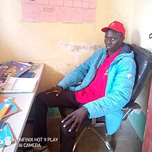
Peoples of Aweil, Lou and Dinka are felt as the huge members of SPLM party among other three major capital cities of Bahr-el-Ghazal region's states.
Sports
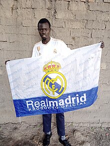
Aweil is sporting town, it has many footballing clubs, it also has fans for Spanish major clubs such as Real Madrid and Barcelona.
Transport
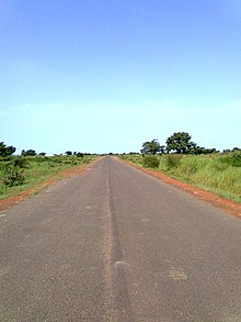
Aweil has a railway station on the line to Wau built in the 1960s. After a period of disuse due to civil war damage, the line and the station were restored to use in 2010. The railway passes through Aweil South County to Wau. Aweil is served by Aweil Airport to Juba. In 2012 the local airline stopped flying.
Governance
The current governor of Northern Bahr El Ghazal state is Tong Akeen Ngor.
Education
University of Northern Bahr el Ghazal is located in eastern Mathiang residential area, just next to western UNMISS Compound.
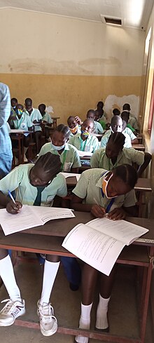
Teachers' Humiliation
On January 12th, 2024; Aweil teachers were seriously beaten, injured and arrested by the South Sudan National Police. 13 teachers were arrested by National Security, over 300 teachers were arrested, 23 were injured and 7 were critically injured by the police. This Aweil Teachers' Humiliation happened after the teachers asked and peacefully protested for their July doctored salaries.
Cathedral
Aweil is also the seat of an Anglican Diocese. Bishop Abraham Nihal is the Bishop of the Diocese of Aweil and the Cathedral is Holy Trinity Cathedral in Aweil, a medium-sized building of brick contraction in the typical cross floorplan common to many churches in Africa.
Aweil Rice Scheme
The Aweil Rice Scheme is a national farming project established by the Sudanese government in Northern Bahr El Ghazal, during the British rule in the late 1940's. It is the biggest rice farm in the country so far, stretching over about 11, 000 hectares.
Points of interest
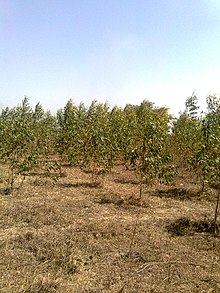
The following points of interest are found in or near Aweil:
- The headquarters of Aweil State Administration
- The headquarters of Aweil Centre County Administration
- The teak plantation is planted in southern Aweil town, to the west of a railway that runs to wau; rumors' circulating the city that the scheme belongs to Paul Malong Awan, the scheme is founded in 2016, for production of electricity-poles.
- The women market was built in Hai-Salaam (Block of Peace) which lies to north-east of Aweil, in 2017 by UNDP prior to economic development and stabilization programmed which aims to address the multi-dimensional needs of people in the region.
- The offices of Aweil Town Council
- South Sudan Hotel - A private hospitality establishment
- Aweil Railway Station
- Aweil Airport
- Aweil Civil Hospital - One of the only three referral hospitals in South Sudan
- St. George Catholic Church - A place of worship
- Aweil Rice Scheme
- Aweil Soccer Field
- University of Northern Bahr El-Ghazal
- St. Mary's Girls Secondary School - A secondary school for girls, owned and administered by the Aweil Dioceses of the Episcopal Church of the Sudan (ECS)
See also
Notable people
References
- "Additional Counties Established In Aweil East > Gurtong Trust > Editorial". www.gurtong.net.
- "Distance between Juba () (Airport) and Uwayl (Shamal Bahr al Ghazal) (Sudan)". distancecalculator.globefeed.com.
- "Floods swamp south Sudan region". BBC News. 1 September 2010.
- Charter, International Air. "Aweil Airport, Sudan". www.internationalaircharter.com.
- "Estimated Population of Aweil In November 2008". Archived from the original on October 2, 2011.
- Ninrew, Chany (2023-05-05). "NBGs decries lack of farming tools, machinery". Eye Radio. Retrieved 2023-05-06.
- "High Level Delegation of UN Agencies and Members of the Donor Community Visit Joint UN Recovery and Stabilisation Programme in Northern Bahr el Ghazal". UNDP in South Sudan.
- "Abraham Nhial Ministry".
External links
 Media related to Aweil at Wikimedia Commons
- Location of Aweil At Google Maps
- Aweil Students graduates Network
| State capitals in South Sudan | |
|---|---|
08°46′48″N 27°24′00″E / 8.78000°N 27.40000°E / 8.78000; 27.40000
Categories: