This is an old revision of this page, as edited by FromCzech (talk | contribs) at 13:23, 10 January 2025 (page created). The present address (URL) is a permanent link to this revision, which may differ significantly from the current revision.
Revision as of 13:23, 10 January 2025 by FromCzech (talk | contribs) (page created)(diff) ← Previous revision | Latest revision (diff) | Newer revision → (diff) River in Czech Republic, Slovakia| Vlára | |
|---|---|
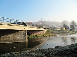
 The Vlára in Bohuslavice nad Vláří The Vlára in Bohuslavice nad Vláří | |
| Location | |
| Countries | |
| Regions (CZ)/ Regions (SK) | |
| Physical characteristics | |
| Source | |
| • location | Drnovice, Vizovice Highlands |
| • elevation | 652 m (2,139 ft) |
| Mouth | |
| • location | Váh |
| • coordinates | 48°57′22″N 18°6′46″E / 48.95611°N 18.11278°E / 48.95611; 18.11278 |
| • elevation | 218 m (715 ft) |
| Length | 44.7 km (27.8 mi) |
| Basin size | 371.6 km (143.5 sq mi) |
| Discharge | |
| • average | 3.4 m/s (120 cu ft/s) near estuary |
| Basin features | |
| Progression | Váh→ Danube→ Black Sea |
The Vlára is a river in the Czech Republic and Slovakia, a right tributary of the Váh. It flows through the Zlín Region in the Czech Republic and through the Trenčín Region in Slovakia. It is 44.7 km (27.8 mi) long.
Etymology
The name is of Celtic origin, derived from the word uolra. The root uel- meant 'to roll', 'rush'.
Characteristic

The Vlára originates in the territory of Drnovice in the Vizovice Highlands at an elevation of 652 m (2,139 ft) and flows to Nemšová, where it merges with the Váh River at an elevation of 218 m (715 ft). It is 44.7 km (27.8 mi) long, of which 33.8 km (21.0 mi) is in the Czech Republic and 10.9 km (6.8 mi) is in Slovakia. Its drainage basin has an area of 371.6 km (143.5 sq mi), of which 303.1 km (117.0 sq mi) is in the Czech Republic.
The longest tributaries of the Vlára are:
| Tributary | Length (km) | Side |
|---|---|---|
| Brumovka | 19.2 | left |
| Smolinka | 15.9 | left |
| Říka | 14.3 | right |
| Rokytenka | 9.2 | right |
Course
The river flows through the territories of Drnovice, Tichov, Vysoké Pole, Vlachova Lhota, Vlachovice, Bohuslavice nad Vláří, Jestřabí, Štítná nad Vláří-Popov and Brumov-Bylnice in the Czech Republic, and continues through the territories of Horné Srnie and Nemšová in Slovakia.
See also
References
- ^ Blažek, Václav (2010-10-07). "Etymological analysis of toponyms from Ptolemy's Description of Central Europe" (PDF). Ulster University. p. 34. Retrieved 2025-01-10.
- ^ "Vodní toky". Evidence hlásných profilů (in Czech). Czech Hydrometeorological Institute. Retrieved 2025-01-10.
- "Zoznam útvarov povrchových vôd v kategórii rieky so zaradením do skupín" (PDF) (in Slovak). Slovak Hydrometeorological Institute. Retrieved 2025-01-10.
- "I.2.1a – Útvary povrchových vod kategorie "řeka"". Charakteristiky dílčího povodí Horní Odry (in Czech). Povodí Moravy, s.p. Retrieved 2025-01-10.
External links
- River flow at Popov station – Flood Warning and Forecasting Service of the Czech Hydrometeorological Institute