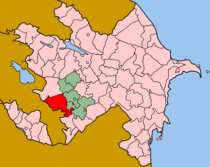
This is an old revision of this page, as edited by Gulmammad (talk | contribs) at 18:18, 21 May 2008 (Reverted edits by 91.103.28.248 (talk) to last version by Kansas Bear). The present address (URL) is a permanent link to this revision, which may differ significantly from the current revision.
Revision as of 18:18, 21 May 2008 by Gulmammad (talk | contribs) (Reverted edits by 91.103.28.248 (talk) to last version by Kansas Bear)(diff) ← Previous revision | Latest revision (diff) | Newer revision → (diff)| This article needs additional citations for verification. Please help improve this article by adding citations to reliable sources. Unsourced material may be challenged and removed. Find sources: "Lachin" – news · newspapers · books · scholar · JSTOR (May 2008) (Learn how and when to remove this message) |
 | |
| Population: | 58.229 |
| Area (sq. km.): | 1.883 |
| Majority people | |
| Majority speaking | |
| Religion | |
| Capital: | Lachin |
| Number of villages | 125 |
| Number of towns | 2 |
Lachin (Template:Lang-az, Template:Lang-hy, Template:Lang-ku) is a town in Azerbaijan and the regional center of the rayon of Lachin. Before 1923, Lachin was called Abdallar. Since 1992 the area has been under the control of the de facto independent unrecognized Nagorno-Karabakh Republic, which has renamed the town Berdzor (Template:Lang-hy). Its Azerbaijani and Kurdish Muslim population fled as a result of the Nagorno-Karabakh War. The town and its surrounding region serve as the strategic Lachin corridor connecting the Nagorno-Karabakh Republic with Armenia.
Lachin Kurds
| This section does not cite any sources. Please help improve this section by adding citations to reliable sources. Unsourced material may be challenged and removed. (February 2008) (Learn how and when to remove this message) |
The town was inhabited by nomadic Kurdish tribes in the 18th century. Eventually, this population became the majority in most parts of the region, particularly around Lachin. The town of Lachin on July 7, 1923, became the capital of Kurdistan Uyezd often known as Red Kurdistan. It was dissolved on April 8, 1929. According to what Bushkapin wrote, official statistics of 1931 showed that there were 3,322 Kurdish speakers in Lachin. These figures did not include those individuals who did not speak Kurdish but nonetheless defined themselves as Kurds. Most of the Kurdish population in Lachin were Shi'a Muslims and were deported by the Soviet authorities, in late 1930s. However, many Kurds still were able to remain in the town and there was a Kurdish minority in the area before the Nagorno-Karabakh war started. In 1992, the Lachin Kurdish Republic was declared in Armenia by a group led by Wekîl Mustafayev, but this attempt failed. Mustafayev took refuge in Italy.
Terrain
The town is scenically built on the side of a mountain on the left bank of Akera river.
Nagorno-Karabakh war
During the occupation of Lachin, May 18, 1992, 333 citizen of Lachin were killed, and 225 people injured. Lachin town and the surrounding rayon were the location of severe fighting during the 1990-1994 Nagorno-Karabakh war, and the town has not recovered from the destruction of that war. Lachin is the most important town under Armenian control because of the Lachin corridor which attaches Armenia to Nagorno-Karabakh. The OSCE Minsk group co-chairs noted that "Lachin has been treated as a separate case in previous negotiations". This is because Lachin is Nagorno Karabakh's humanitarian and security corridor. Without it, Nagorno-Karabakh would remain an isolated enclave. It is because of Lachin's political and geographic reality and security dimension, that it is viewed differently in the negotiation process. The Lachin corridor and the Kelbajar district have been at the center of Armenian demands during the Nagorno-Karabakh peace talks with Azerbaijan.
Administrative divisions
Before the Nagorno-Karabakh war there were 125 villages, one city-type settlement, Minkend, and the capital city in the Lachin district.
Culture and Infrastructure
Before the Nagorno-Karabakh war, in Lachin there were 101 High Schools, 142 Hospitals, and more than 200 historical monuments belong to IX-XV centuries.
Ethnic Groups
Lachin was mainly populated by Azerbaijanis and Kurds before the Nagorno-Karabakh war.
Religious
See also
External links
- Pictures of Lachin
- Demographic Crisis in Lachin (Berdzor)
- More information about Lachin (Berdzor) from Armeniapedia.com
- "Lachin (Berdzor)". Azerb.com. Retrieved 2007-02-04.
Notes
- 1992 census in Azerbaijani
- ANS How Lachin was occupied? (in Azerbaijani)
- Karapetian, Samvel. Armenian Cultural Monuments in the Region of Karabagh. Yerevan: Gitutiun Publishing House, 2001, p. 169.
- Map of Armenia and Adjacent Countries by H. F. B. Lynch and F. Oswald, London, 1901.
- Holding, Nicholas (2006). Armenia with Nagorno Karabagh, 2nd: The Bradt Travel Guide. Guilford, Connecticut: Globe Pequot Press, p. 208. ISBN 1-8416-2163-3.
- http://www.kurdmedia.com/articles.asp?id=7856
- Great Soviet Encyclopedia
- Radio Free Europe/Radio Libertyin Azerbaijani
- http://72.14.253.104/search?q=cache:0Sxzs0-JPsIJ:www.armeniaemb.org/ArmeniaUS/NKPeaceProcess/NKRPeaceStatement170305.htm+Lachin+Nagorno-Karabakh&hl=en&ct=clnk&cd=8&gl=us
- CountryWatch - Interesting Facts Of The World
- Radio Free Europe/Radio Libertyin Azerbaijani
- How Lachin was occupied in Azerbaijani
39°38′N 46°33′E / 39.633°N 46.550°E / 39.633; 46.550
Categories: