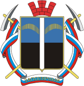
This is an old revision of this page, as edited by Idioma-bot (talk | contribs) at 15:05, 6 May 2012 (r2.7.2) (Robot: Adding lt:Zapoliarnas). The present address (URL) is a permanent link to this revision, which may differ significantly from the current revision.
Revision as of 15:05, 6 May 2012 by Idioma-bot (talk | contribs) (r2.7.2) (Robot: Adding lt:Zapoliarnas)(diff) ← Previous revision | Latest revision (diff) | Newer revision → (diff)69°25′N 30°48′E / 69.417°N 30.800°E / 69.417; 30.800

Zapolyarny (Template:Lang-ru) is a town in Pechengsky District of Murmansk Oblast, Russia, located on the Kola Peninsula, 10 kilometers (6.2 mi) south of the Kola Superdeep Borehole project. Population: 18,640 (2002 Census); 23,564 (1989 Soviet census).
The area where the town is located belonged to Finland in 1920–1944. It was founded in 1956 as Zhdanovsk (Жда́новск) and was granted work settlement status and later given its present name.
On February 1, 1963, by the Decree by the Presidium of the Supreme Soviet of the RSFSR, Zapolyarny was elevated in status to that of a town of district significance.
Gallery
References
Notes
- Federal State Statistics Service (21 May 2004). Численность населения России, субъектов Российской Федерации в составе федеральных округов, районов, городских поселений, сельских населённых пунктов – районных центров и сельских населённых пунктов с населением 3 тысячи и более человек [Population of Russia, Its Federal Districts, Federal Subjects, Districts, Urban Localities, Rural Localities—Administrative Centers, and Rural Localities with Population of Over 3,000] (XLS). Всероссийская перепись населения 2002 года (in Russian).
- Всесоюзная перепись населения 1989 г. Численность наличного населения союзных и автономных республик, автономных областей и округов, краёв, областей, районов, городских поселений и сёл-райцентров [All Union Population Census of 1989: Present Population of Union and Autonomous Republics, Autonomous Oblasts and Okrugs, Krais, Oblasts, Districts, Urban Settlements, and Villages Serving as District Administrative Centers]. Всесоюзная перепись населения 1989 года (in Russian). Институт демографии Национального исследовательского университета: Высшая школа экономики . 1989 – via Demoscope Weekly.
- Administrative-Territorial Division of Murmansk Oblast, p. 56
Sources
- Архивный отдел Администрации Мурманской области. Государственный Архив Мурманской области. (1995). Административно-территориальное деление Мурманской области (1920–1993 гг.). Справочник. Мурманск: Мурманское издательско-полиграфическое предприятие "Север".
| Administrative divisions of Murmansk Oblast | |
|---|---|
| Administrative center: Murmansk • Rural localities | |
| Administrative districts | |
| Closed administrative-territorial formations | |
| Cities and towns (all levels) | |
| Urban-type settlements | |
This Murmansk Oblast location article is a stub. You can help Misplaced Pages by expanding it. |

